





First, What Is SAR?
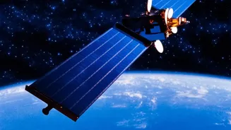
Synthetic Aperture Radar, or SAR, is a powerful form of radar used to create high-resolution images of the Earth's surface. Unlike optical satellites that need daylight and clear skies, SAR can see through clouds, fog, and darkness. It works by sending
microwave signals to the ground and then analysing the echoes that bounce back. This all-weather, day-and-night capability makes it incredibly valuable for a wide range of applications, from monitoring floods and landslides to tracking agricultural health and urban development. With India's own series of RISAT (Radar Imaging Satellite) spacecraft, expertise in SAR is becoming increasingly important.
Inside the ISRO Course Curriculum
The courses, typically offered by the Indian Institute of Remote Sensing (IIRS), an ISRO centre, are designed to build capacity in geospatial technologies. While specific course content may vary, they generally cover the fundamentals of SAR, including the principles of microwave remote sensing, SAR system parameters, and different imaging modes. Students can expect to learn about SAR data processing, including techniques like polarimetry (analysing the polarisation of radar waves) and interferometry (using multiple images to detect surface changes). The curriculum often includes hands-on sessions using open-source software and real-world case studies, sometimes with a special focus on data from ISRO's own satellites like RISAT-1A.
Who Is This Course For?
These outreach programmes are designed for a broad audience. The primary target groups are university students (both undergraduate and postgraduate), researchers, and faculty members interested in remote sensing. However, the courses are also highly relevant for professionals and technical staff from government and private organisations who work in fields like disaster management, environmental monitoring, and urban planning. Essentially, anyone with a foundational knowledge of remote sensing and image processing who wants to upgrade their skills with a powerful, in-demand technology is an ideal candidate. These courses are frequently offered free of cost to expand the reach of geospatial science.
A Major Career Advantage
Gaining expertise in SAR data analysis can provide a significant career boost. As India expands its space-based observation capabilities, including the joint NASA-ISRO SAR (NISAR) mission, the demand for skilled analysts is growing. Proficiency in SAR is directly applicable to crucial sectors. In disaster management, it's used for flood mapping and assessing damage from cyclones and earthquakes. In agriculture, it helps in monitoring crop health and soil moisture. Other key areas include defence, infrastructure monitoring, urban planning, and tracking environmental changes like deforestation and glacial melt. A certificate from an ISRO-run course adds substantial credibility to a resume and opens doors to careers in space tech, environmental science, and data analytics.
How to Enrol and Get Certified
Enrolment is typically handled online through the IIRS website. Prospective participants usually need to register on the e-learning portal. For students or faculty, this may involve selecting their institution from a network of nodal centres. The courses are delivered through a mix of live interactive classes, video lectures, and downloadable study materials. To earn a certificate, participants generally need to meet an attendance requirement, often around 70%, and in some cases, pass an online examination. Since these courses are popular, it's wise to keep an eye on the official IIRS outreach or news page for announcements on upcoming schedules and registration windows.