



A New Eye in the Sky
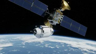
The incredible new views come from NISAR, the NASA-ISRO Synthetic Aperture Radar satellite, a joint mission between the United States and India. Launched in July 2025, NISAR is not like a typical satellite with a camera that takes pictures using visible
light. Instead, it uses a sophisticated radar system to bounce microwave signals off the Earth's surface and measure the echoes that return. This technology allows it to see through clouds, darkness, and even dense vegetation, providing an uninterrupted look at the planet's surface day or night, in any weather. With its massive 12-metre wide radar antenna reflector, the largest NASA has ever launched, NISAR can detect changes in Earth's surface as small as a centimetre.
The Science of Seeing the Unseen
NISAR is the first satellite mission to use two different radar frequencies—L-band and S-band—to study Earth. The L-band radar, provided by NASA, has a longer wavelength that can penetrate deeper through surfaces like snow, ice, and forest canopies. The S-band radar, built by ISRO, uses a shorter wavelength that is excellent for studying things like soil moisture and lighter vegetation. For Antarctica, the L-band radar is particularly revolutionary. It sends horizontally polarised radar waves toward the ice. By analysing how those signals bounce back—whether they remain horizontal or change to a vertical polarisation—scientists can map the hidden world beneath the snow. Smooth ice might reflect the signal back uniformly, while deep cracks and complex internal ice structures will scatter the signal in different ways. This allows researchers to see features that are completely invisible to optical satellites.
What the 'Hummingbird' Reveals
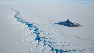
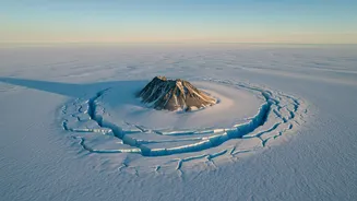
One of the most striking early images released by the mission team shows a feature in East Antarctica that scientists have nicknamed the "hummingbird." The image reveals a mountaintop, known as a nunatak, poking through a massive ice stream. As the glacier flows around this rocky obstacle, the immense stress causes the ice to fracture into a network of deep cracks, or crevasses. When viewed with NISAR's radar, these crevasses form a shape that uncannily resembles a bird with outstretched wings. In a normal satellite photo, this entire area would be an almost featureless sheet of white. But NISAR’s image, rendered in vibrant colours, distinguishes between smooth ice (magenta) and heavily fractured areas (green), revealing the dynamic forces at play. It’s a beautiful demonstration of how the satellite can expose the hidden structure and movement of the ice.
Why Monitoring Antarctica Matters
These new capabilities are more than just a technological marvel; they are critical for understanding and responding to climate change. The Antarctic and Greenland ice sheets are the largest reservoirs of fresh water on Earth. As they melt, they contribute directly to global sea-level rise. By providing unprecedented detail on how these ice sheets are flowing, thinning, and breaking apart, NISAR will help scientists create more accurate models of future sea-level rise. The mission will systematically scan nearly all of Earth's land and ice surfaces every 12 days, creating a time-lapse view of planetary changes. This data, now publicly available, will be essential not only for polar science but also for monitoring natural hazards like earthquakes, volcanoes, and landslides across the globe.