






A Fragile Green Fortress
Stretching across India and Bangladesh, the Sundarbans is the world's largest mangrove ecosystem and a UNESCO World Heritage Site. For the millions living in coastal West Bengal, it is more than just a forest; it's a life-saving barrier. The dense network
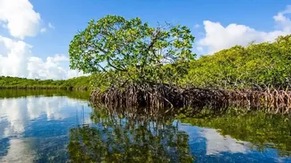
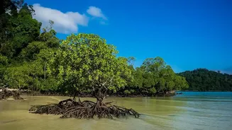
of mangrove trees and their intricate root systems act as a natural shock absorber, dissipating the energy of storm surges and high-speed winds from cyclones that form in the Bay of Bengal. However, this vital ecosystem is facing immense pressure from climate change, rising sea levels, and increasing salinity, which can degrade the health of the mangroves and weaken this crucial coastal defense. Manually monitoring such a vast, remote, and often inaccessible area is nearly impossible, making it difficult for authorities to know where the forest is thriving and where it is vulnerable.
An Eye in the Sky
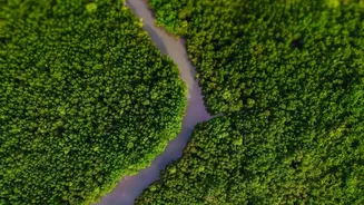
This is where satellite technology, particularly remote sensing, becomes a game-changer. Satellites from international programs like Landsat and Sentinel, as well as India's own constellation of Indian Remote Sensing (IRS) satellites, provide a powerful and non-intrusive way to monitor the Sundarbans. These satellites repetitively scan the entire region, collecting data across different light spectrums, far beyond what the human eye can see. This synoptic view allows researchers to create detailed maps of the entire coastline and track changes over months, years, and even decades. By analysing this stream of data, scientists can assess the health, density, and spatial extent of the mangrove forests with remarkable accuracy, turning images from space into actionable intelligence on the ground.
Decoding Mangrove Health from Space
So how does it work? Healthy vegetation reflects light differently than stressed or sparse vegetation. Satellites measure these subtle differences. Scientists use various 'vegetation indices', like the well-known Normalized Difference Vegetation Index (NDVI), to translate this data into a measure of plant health. A high NDVI value indicates dense, healthy foliage, while a low value can signal stress, degradation, or a shift from forest to bare soil or water. More advanced techniques use specific spectral bands, such as shortwave infrared (SWIR), to create specialized indices like the Discriminant Normalised Vegetation Index (DNVI), which is particularly effective for assessing mangrove health. This allows researchers to not only map the area of the forest but also to create a detailed health report card, identifying 'greening' trends where forests are recovering and 'browning' trends where they are in decline.
From Data to Defense Strategy
This satellite data is far more than just an academic exercise. It directly informs conservation and disaster management strategies. By pinpointing areas where mangroves are degrading, forestry departments can target their restoration and plantation efforts more effectively. For example, studies have used decades of Landsat data to analyse the resilience of the Sundarbans to cyclones and the long-term effects of climate change. When a satellite map shows a weakening in the mangrove barrier along a particular stretch of coast, it serves as an early warning for disaster management agencies. This information allows them to identify which coastal villages are at increased risk from storm surges and to implement protective measures, potentially saving lives and property.
The Future of Coastal Resilience
The fusion of satellite technology and environmental science offers a hopeful path forward for the Sundarbans. As data collection methods become more sophisticated—using high-resolution imagery and advanced machine learning algorithms—our understanding of this complex ecosystem will only deepen. This technology helps quantify the immense value of mangroves, not just as a biodiversity hotspot, but as a critical piece of natural infrastructure for coastal defense. Long-term monitoring projects, often supported by government bodies like the Department of Science and Technology, are crucial for tracking mangrove dynamics and predicting future changes. By continuing to invest in both natural restoration and technological monitoring, India can better protect this invaluable ecological treasure and the coastal communities that depend on it for their survival.