


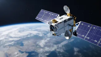


What Is EOS-05?
EOS-05 is an Earth observation satellite, but it's not like the ones you might be used to. Developed by ISRO, it is designed to provide near real-time imaging of the Indian subcontinent from a very high altitude. Think of it as a persistent, watchful
eye. Previous Earth observation satellites in the Indian Remote Sensing (IRS) series typically operate in Low Earth Orbits, meaning they circle the globe and pass over a specific location periodically. EOS-05, however, is built for a special kind of orbit that allows it to stay over the same general area, providing a continuous stream of information. It carries sophisticated imaging tools, including multi-spectral cameras that can see in visible, near-infrared, and short-wave infrared bands, allowing it to capture a wide range of data about the land, water, and atmosphere.
The Magic of a Geosynchronous Orbit
The key to EOS-05's mission is its destination: a geosynchronous orbit, approximately 36,000 kilometres above the Earth's equator. At this specific altitude, a satellite's orbital speed matches the speed of the Earth's rotation. From our perspective on the ground, the satellite appears to hover over a fixed spot. This is a huge advantage for monitoring applications. Instead of getting a snapshot of a location once every few days, a geosynchronous satellite can watch events unfold continuously. This constant vigil is what makes EOS-05 a game-changer for applications that require timely updates, such as tracking weather systems or managing natural disasters.
A Game-Changer for Disaster Management
One of the most significant benefits of EOS-05 will be in disaster management. India's existing satellites already play a crucial role in tracking cyclones and mapping flood-affected areas. However, the ability of EOS-05 to provide rapid, repeated imaging of a large area takes this to a new level. The satellite is expected to be able to image the entire Indian landmass every 30 minutes, and specific areas of interest in as little as five minutes. During a developing cyclone, a flash flood, or a widespread forest fire, this near real-time information can be invaluable for emergency response teams, enabling faster evacuations and more effective deployment of resources.
Boosting Agriculture and Water Security
Beyond emergencies, EOS-05 promises to be a powerful tool for managing India's natural resources. The satellite's multi-spectral imagers can monitor crop health, detect moisture stress in soil, and assess vegetation cover over large agricultural belts. This data can help create more accurate crop yield estimates, support crop insurance schemes like the Pradhan Mantri Fasal Bima Yojana, and provide farmers with advisories for irrigation and pest control. It will also aid in monitoring the country's water resources, from the snow-melt runoff in the Himalayas to the water levels in reservoirs, helping to manage a resource that is critical to the nation's economy and well-being.
Strengthening National Interests
Like many advanced space technologies, Earth observation satellites have dual-use capabilities. While its primary mission is focused on civilian applications like weather and resource management, the persistent surveillance offered by a geosynchronous imager also has clear strategic value. The ability to continuously monitor large areas of interest, including land borders and maritime zones, enhances India's situational awareness. This constant watch strengthens the country’s ability to monitor its strategic environment from a secure and sovereign platform high above the Earth.