





A Game-Changer in a Fixed Orbit
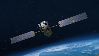
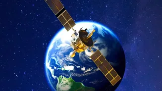
Most Earth observation satellites operate in a Low-Earth Orbit, circling the globe and capturing images of a specific location only when they pass overhead. EOS-05 is different. It is an imaging satellite designed for a geostationary orbit, approximately
36,000 kilometres above the equator. From this position, its orbital period matches Earth's rotation, allowing it to remain fixed over the Indian subcontinent. This provides the unprecedented ability to monitor a vast area continuously, a feature common for communication and weather satellites but a first for a high-resolution Indian imaging satellite. The EOS-05, carried by a GSLV-F17 rocket, is a state-of-the-art spacecraft intended as a replacement for the GISAT-1 (EOS-03) mission, which was lost during a launch failure in 2021.
Near Real-Time Monitoring
The key advantage of a geostationary imager is speed. EOS-05 is designed to provide images of the entire Indian landmass roughly every 30 minutes. For specific areas of interest, it can deliver images as frequently as every five minutes. This near real-time capability is revolutionary for managing dynamic and rapidly evolving events. Instead of waiting for a satellite to pass over a developing cyclone or a spreading forest fire, authorities can receive a continuous stream of data. This allows for quicker, more informed decision-making during natural disasters, helping to coordinate rescue efforts, evacuate populations, and assess damage with much greater efficiency.
Bolstering National Security
Beyond disaster management, the strategic implications of EOS-05 are profound. Having a constant eye over the region significantly enhances India's surveillance capabilities. The satellite will be able to monitor border areas, track movements across land and sea, and provide critical intelligence for defence purposes. While many ISRO satellites have dual civilian and military use, some reports indicate that future GISAT missions may be specifically for strategic purposes, with dedicated payloads for the Indian Navy to monitor the crucial Indian Ocean Region. This persistent monitoring is a powerful tool for safeguarding national interests and maintaining geopolitical stability.
A New Era for Resource Management
The satellite’s multi-spectral and hyper-spectral imaging instruments will provide valuable data for a wide range of civilian applications. These include agriculture, forestry, mineralogy, and oceanography. By observing changes in vegetation, soil moisture, and water bodies over time, EOS-05 can help in assessing crop health, managing water resources more effectively, and monitoring environmental changes like deforestation and desertification. This continuous stream of data complements the information gathered by India's existing fleet of remote sensing satellites, which includes the Resourcesat, Cartosat, and Oceansat series, creating a more comprehensive and robust picture of the nation's natural resources.
Building on a Powerful Legacy
The upcoming EOS-05 launch, scheduled for early September 2026, is a critical mission for ISRO, marking a return to its ambitious geo-imaging programme. It represents the next evolutionary step for what is already one of the world's largest constellations of remote sensing satellites. By adding this 'geostationary eye' to its arsenal, India not only enhances its ability to protect its people and manage its resources but also solidifies its position as a leading space-faring nation. The success of this mission will pave the way for a new generation of satellites that offer even more advanced and timely insights into our planet.