






A Landmark Partnership in Orbit
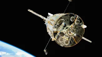
At the heart of this mission is the NASA-ISRO Synthetic Aperture Radar, or NISAR, satellite. Launched from India's Satish Dhawan Space Centre, it represents a monumental collaboration between the two space agencies. ISRO provided the powerful S-band radar,
the spacecraft bus, and the launch vehicle, a clear demonstration of India's world-class space capabilities. NASA contributed the L-band radar and other critical systems. This isn't just a technical achievement; it's a symbol of the growing strategic partnership between India and the US, leveraging cutting-edge technology to tackle global challenges. The mission, one of the most expensive Earth-imaging satellite projects ever, will scan nearly the entire planet every 12 days, providing a torrent of open-access data for scientists worldwide.
The Technology That Sees the Unseen
So, how does NISAR see through ice? It doesn't use a camera in the traditional sense. Instead, its two radar systems (L-band and S-band) act like a planetary-scale ultrasound, sending microwave signals to Earth and analysing the echoes that bounce back. Because these radar waves can penetrate clouds, darkness, and, crucially, surface layers of snow and ice, NISAR can 'see' what optical satellites can't. This all-weather, day-or-night capability is a game-changer for studying remote and often-clouded regions like the Himalayas and the poles. The satellite can detect tiny changes in the Earth's surface—as small as a centimetre—allowing it to track the subtle, and sometimes not-so-subtle, movements of glaciers, ice sheets, and the very ground beneath our feet.
Revealing Antarctica’s Hidden World
Recent data from NISAR has already delivered stunning results from Antarctica. One of the first images released captured a feature nicknamed 'the hummingbird'—a shape created by a rocky mountaintop, or nunatak, disrupting the flow of a glacier and causing deep cracks in the ice around it. While visually striking, the image provides rich scientific detail on how glaciers move and fracture. By peering beneath the surface snow, NISAR gives scientists an unprecedented view of the structures within the ice and the dynamics of glacial flow. This allows them to monitor the grounding lines of glaciers—the critical point where ice meets the warming ocean—and understand how ice sheets are responding to climate change with far greater precision than ever before.
Why Antarctica’s Ice Matters for India
The processes NISAR is observing at the South Pole have direct consequences for India. The Antarctic ice sheet is the world's largest reservoir of fresh water, and its melt rate is a primary driver of global sea-level rise. For a country with an extensive coastline of over 7,500 kilometres, featuring major cities like Mumbai, Chennai, and Kolkata, this is not a distant threat. It's an impending reality. The data NISAR provides on ice sheet stability and melt dynamics will be fed into climate models, making projections of future sea-level rise more accurate. This information is vital for India to plan, prepare, and build resilience against increased coastal flooding, erosion, and storm surges that threaten millions of people and critical infrastructure.
More Than Just Ice
While its polar research is groundbreaking, NISAR's mission scope extends across the entire globe, with specific benefits for India. The same technology used to track ice movement can monitor seismic activity in the tectonically active Himalayan region, potentially offering insights into earthquake hazards. It will also be used to track deforestation, measure agricultural biomass, and monitor groundwater supplies—all critical for sustainable resource management in a country as populous and dynamic as India. By providing consistent, high-resolution data, NISAR will become an invaluable tool for disaster management, environmental protection, and agricultural planning across the nation.