


Seeing with Sound: The Basics of Sonar
Sonar, which stands for SOund Navigation And Ranging, is the foundational tool for modern underwater exploration. The principle is simple, much like a bat using echolocation. A device sends out a pulse of sound, known as a 'ping'. This sound wave travels
through the water until it hits an object, like the seafloor or a shipwreck. It then bounces off and returns as an echo to a receiver. By measuring the time it takes for the echo to return, scientists can calculate the distance to the object with remarkable precision. Since light doesn't travel far underwater, sound waves are the most effective way to map vast, unseen landscapes.
The Archaeologist's High-Tech Toolkit
Archaeologists don't use just one type of sonar; they have a specialised toolkit for different tasks. The two most common types are side-scan and multibeam sonar. Side-scan sonar involves a torpedo-shaped device, called a 'towfish', that is pulled behind a boat. It emits fan-shaped sound beams to either side, creating a wide-area picture of the seabed. This is excellent for covering large survey areas quickly to look for anomalies. Multibeam sonar, often mounted on the hull of a ship, sends out a whole fan of sound beams at once. This provides much more detailed, 3D-mappable data, creating high-resolution images of underwater features. For seeing what lies beneath the seabed, archaeologists use a sub-bottom profiler, which uses low-frequency sound waves to penetrate sediment and reveal buried structures.
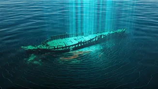
From Pings to Pictures: Interpreting the Data
The raw data from a sonar scan is not a photograph but a collection of acoustic reflections. Specialised software processes these millions of data points, translating them into detailed images. Hard objects like rock or metal create a strong echo (appearing darker in many visualisations), while soft materials like mud create a weaker one. A crucial element is the 'acoustic shadow'. Just as an object blocks light to create a shadow, a shipwreck will block sound waves, creating a silent 'acoustic shadow' behind it. The shape and length of this shadow can tell an experienced operator a lot about the object's height and form, even before a camera goes into the water.
Uncovering Clues on India's Coasts
This technology has been instrumental in exploring India's rich maritime history. The search for the legendary city of Dwarka, off the coast of Gujarat, has heavily relied on sonar surveys. Marine archaeologists from the National Institute of Oceanography and the Archaeological Survey of India have used side-scan sonar to map the seabed, identifying stone structures, walls, and clusters of ancient anchors that suggest a large, ancient settlement. Recent surveys have provided precise targets for future excavations. Similarly, off the coast of Tamil Nadu, sonar and other remote-sensing technologies are being used to map the submerged ruins of Poompuhar, a legendary port city of the Chola dynasty mentioned in Sangam literature. These surveys have revealed what appear to be man-made structures and a potential harbour, offering a tantalising glimpse into a city swallowed by the sea.
Beyond the Sonar Scan
Finding an anomaly with sonar is just the first exciting step. It provides a map of potential targets, but it doesn't definitively identify them. An unusual shape could be a shipwreck, but it could also be a unique rock formation. The next step is visual verification. Archaeologists deploy Remotely Operated Vehicles (ROVs), which are small, unmanned submarines equipped with high-definition cameras and lights. The ROV can be navigated to the target identified by the sonar to provide the first visual confirmation of what's there. If the site is promising and accessible, human divers will follow to conduct more detailed surveys, take measurements, and potentially excavate artefacts. Sonar provides the map, but ROVs and divers read the details.