





The Hidden Dangers of a Flooded Road
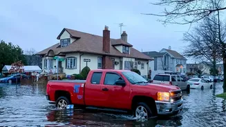
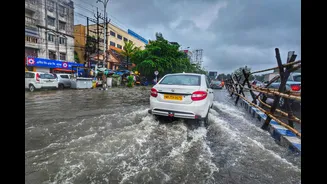
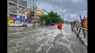
The most common mistake is underestimating the water. A stretch of road that looks like a shallow puddle could be hiding serious dangers. Just six inches of moving water can be enough to make a driver lose control of their car, and a foot of water is sufficient
to float many vehicles, turning them into unsteerable vessels at the mercy of the current. The water also conceals threats like open manholes, deep potholes, and sharp debris that can damage tires and undercarriages. Furthermore, water entering the engine's air intake can cause 'hydrostatic lock,' a catastrophic failure that can damage the engine beyond repair, leading to lakhs in expenses that many insurance policies may not cover if you willingly drove into a waterlogged area.
Your GPS Might Lead You Astray
In a crisis, our first instinct is often to turn to technology. However, standard navigation apps may not be your best guide during a flood. While they are excellent at finding the fastest route based on typical traffic, they often lack real-time data on waterlogging. Your GPS might diligently direct you towards a shortcut that has, in reality, become an impassable water body. Relying solely on these apps can inadvertently lead you from a safe area directly into a flooded one. They see a clear road on the map, but fail to account for the several feet of water covering it, making them an unreliable tool when water levels rise.
Smarter Navigation: Tools and Tactics That Work
Effective route planning during floods requires a more dynamic approach. This is where official and community-sourced information becomes vital. The Indian government has developed the 'FloodWatch' app, which provides real-time flood forecasts and data from hundreds of monitoring stations across the country. This tool, developed by the Central Water Commission, offers forecasts up to seven days in advance and can provide location-specific risk assessments. Beyond official apps, local traffic police departments often post real-time updates on social media platforms about road closures and waterlogged areas. Community-based navigation apps can also be useful, as they allow users to report flooding, accidents, and other hazards in real-time. Combining these sources gives you a much clearer picture of the ground reality than a standard map.
Why Your Journey Affects Everyone
A single car stalled in a flooded underpass does more than just inconvenience the driver. It creates a bottleneck that can paralyze a whole section of the city. More critically, it can block the path for emergency services. Flooded roads significantly delay the response times for ambulances, fire engines, and police, jeopardizing lives in critical situations. Studies have shown that waterlogging severely impedes the efficiency of emergency responders, at a time when their services may be in higher demand. By choosing a safe route or deciding not to travel at all, you are not just protecting yourself; you are helping to keep vital arteries open for those who need them most. Responsible travel during a flood is a civic duty.
The Best Plan: Think Before You Drive
The most effective route planning happens before you even get in the car. The first and simplest rule is to avoid driving through flooded areas whenever possible. If heavy rain is forecast, check official sources like the India Meteorological Department (IMD) and the NDMA for advisories. Look at real-time traffic updates and social media to see which areas are already affected. If you absolutely must travel, inform someone of your intended route and estimated time of arrival. Have a backup plan with an alternative, safer route. Often, the wisest and safest decision during severe urban flooding is to postpone your journey and wait for the water to recede. No destination is worth risking your life or your vehicle for.