


A New Eye in the Sky
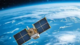
NISAR, which stands for NASA-ISRO Synthetic Aperture Radar, is a joint Earth-observing mission between the American and Indian space agencies. Launched in July 2025, this sophisticated satellite is the first to use two different radar frequencies to systematically
map our planet. Its primary goal is to observe and measure some of Earth's most complex processes, from the slow creep of glaciers to the abrupt devastation of earthquakes and floods. For India, this collaboration provides a powerful national asset for disaster management, agriculture, and infrastructure planning.
Seeing Through the Storm
Unlike optical satellites that are blinded by clouds and darkness, NISAR uses Synthetic Aperture Radar (SAR). This technology sends microwave pulses to the Earth's surface and analyses the signals that bounce back. Since radar creates its own light source, it can see through thick cloud cover, heavy rain, and the dark of night—conditions that almost always accompany major flooding events. This all-weather, day-night capability is a fundamental advantage, ensuring that disaster response teams receive critical information when it's needed most, not just when the skies clear.
The L-Band and S-Band Advantage
NISAR is unique because it carries both an L-band and an S-band radar. Think of these as two different tools for seeing the world. The S-band, provided by ISRO, is excellent for observing near and far weather and capturing the top layer of vegetation. The L-band, provided by NASA, uses a longer wavelength that can penetrate deeper, seeing through forest canopies and into the soil. For floods, this is revolutionary. Open water appears dark in radar images, but water hidden under a forest canopy actually makes the signal brighter, allowing scientists to map inundation even in dense jungles and agricultural areas. This dual-frequency approach provides a much more complete picture of where the water is and what it's doing.
Why High-Frequency Data Is a Game Changer
While NISAR orbits the entire globe every 12 days, its wide scanning area and rapid data processing enable an unprecedented flow of information. For emergencies, data can be made available within hours of an observation, a crucial detail mentioned in the headline. This transforms flood tracking from a reactive to a proactive exercise. Instead of just getting a snapshot before and after a flood, authorities can receive a continuous stream of maps showing how water levels are changing. This allows them to see a flood evolve, predicting where it will go next and how severe the impact will be. It's like having a virtual stream gauge covering entire river basins. This frequency of observation is what truly separates NISAR from previous missions, allowing for near-daily insights into developing situations.
From Mapping to Management
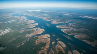
The detailed, frequent maps produced by NISAR have direct, life-saving applications. They enable more accurate early warnings for communities downstream, helping them evacuate in time. Relief and rescue teams can use the inundation maps to understand which roads are cut off and which villages are most affected. For agriculture, the data can be used to assess crop damage with high precision, which is vital for insurance and aid distribution. As seen in floods in Mozambique in early 2026, NISAR's data provided clear views of the disaster's extent, cutting through clouds that obscured other satellites' views. This level of detail helps officials manage resources more effectively, both during the crisis and in the recovery phase.