


What the IMD is Forecasting
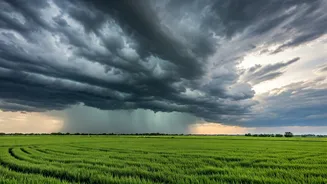
According to the latest bulletins from the IMD, a combination of weather systems, including an active Western Disturbance interacting with moisture-laden monsoonal winds, is set to trigger widespread rainfall over the next few days. The forecast points
towards moderate to heavy, and in some isolated areas, very heavy rainfall. This isn't just a passing shower; meteorologists are describing it as a significant 'wet spell', meaning a multi-day period of persistent rain. The intensity is expected to peak over a 48-to-72-hour window, with authorities on high alert for the associated consequences. These systems are common during the monsoon transition, but the predicted intensity has prompted specific warnings to be issued.
Which Areas Are on High Alert?
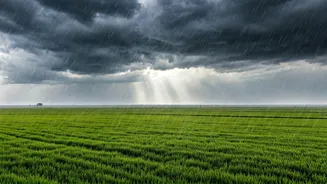
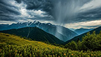
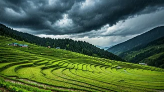
The IMD's advisory covers a large swathe of Northwest India. The regions expected to bear the brunt of the downpour include Punjab, Haryana, Chandigarh, and Delhi, where urban infrastructure will be tested. Significant rainfall is also predicted for parts of West Uttar Pradesh and North Rajasthan. The Himalayan states of Himachal Pradesh and Uttarakhand are on particularly high alert. For these hilly regions, heavy rainfall brings an elevated risk of flash floods, cloudbursts, and landslides. The IMD has issued colour-coded warnings, with several districts under an 'Orange Alert', urging residents and authorities to be prepared for disruptive weather events. It is crucial for residents in these states to monitor local weather updates, as conditions can change rapidly.
Potential Risks and Disruptions
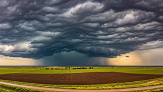
A massive wet spell of this nature brings a predictable set of challenges. In major cities like Delhi, Gurugram, and Chandigarh, the primary concern is severe waterlogging and urban flooding. This can lead to massive traffic snarls, submerged underpasses, and disruptions to public transport. Power outages are also a possibility as infrastructure comes under strain. In agricultural belts like Punjab and Haryana, heavy rain could potentially damage standing crops, a major concern for the farming community. For those in or travelling to Himachal Pradesh and Uttarakhand, the risks are more severe. Saturated soil can lead to landslides, blocking highways and isolating communities. Rivers and streams can swell rapidly, creating dangerous flash flood situations. Authorities have already advised tourists to exercise extreme caution.
A Guide to Staying Safe
Preparedness is key to navigating such weather events safely. First, avoid unnecessary travel, especially during peak rainfall periods. If you must travel, check traffic advisories and avoid routes prone to waterlogging. Never attempt to drive or walk through flooded areas, as the depth and current can be deceptive. At home, ensure your drains are clear to prevent localised flooding. Secure any loose objects on balconies or rooftops that could be blown away by strong winds accompanying the rain. It's also wise to have an emergency kit ready with essentials like a torch, first-aid supplies, dry food, and drinking water. Charge your electronic devices and power banks in case of power cuts. For those in hilly areas, stay away from rivers and streams and be prepared to move to safer locations if instructed by local authorities.
Following Official Advisories
During extreme weather, misinformation can spread quickly. It is vital to rely only on official sources for information. The IMD regularly updates its forecasts and warnings on its official website (mausam.imd.gov.in) and social media channels. National and State Disaster Management Authorities (NDMA and SDMAs) will also issue specific guidelines and safety instructions. Pay close attention to local news channels and administrative announcements for area-specific information regarding road closures, evacuations, or relief measures. Following these official channels ensures you receive accurate, timely, and actionable information to keep you and your family safe.