

What is Synthetic Aperture Radar (SAR)?
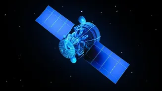
Synthetic Aperture Radar, or SAR, is a powerful remote sensing technology used on satellites and aircraft. Unlike standard optical cameras that need light and clear skies, SAR can see through clouds, smoke, and darkness. It works by sending out microwave
pulses towards the Earth's surface and then recording the signals that bounce back. By processing these echoes, scientists can create highly detailed, three-dimensional images of the landscape. This 'synthetic aperture' technique allows a small, moving antenna on a satellite to function like a much larger, more powerful one, capturing incredibly precise data day or night, in any weather.
Why This Skill Matters for India
SAR technology is not just for exploring distant planets; it has critical applications right here on Earth. For a country like India, with its diverse geography and susceptibility to natural calamities, SAR is a game-changer. It is used for disaster management, such as monitoring floods and assessing earthquake damage. It helps in agriculture by monitoring crop health and soil moisture, and plays a vital role in national security by providing all-weather surveillance. Furthermore, with the upcoming NASA-ISRO SAR (NISAR) mission, which will map the entire globe every 12 days, the demand for professionals skilled in SAR data analysis is set to soar. Learning SAR is a direct ticket to participating in projects of national importance.
ISRO’s Free Training Opportunities
ISRO, primarily through its premier training centre, the Indian Institute of Remote Sensing (IIRS) in Dehradun, regularly offers free online courses for students and professionals. These outreach programmes are designed to build capacity in geospatial technologies. The courses often come in the form of Massive Open Online Courses (MOOCs) or live, interactive sessions that cover topics like SAR data processing and its applications. These programmes are designed to be self-paced and learner-centric, providing study materials like video lectures, presentations, and practical demonstrations using open-source software. Students who successfully complete the course, often based on attendance and an online exam, receive a certificate from IIRS-ISRO.
Who is Eligible and How to Apply
Eligibility for these courses is broad, aiming to include a wide range of participants. Typically, undergraduate and postgraduate students from any year of study are welcome to apply. The courses are also open to technical or scientific staff from government departments, as well as faculty and researchers from universities and institutions. The application process is straightforward and conducted online through the IIRS portal. Prospective participants usually need to register on the website, select their course of choice, and fill in their personal and educational details. Some programmes may require applicants to register through their own college if it is a designated nodal centre.
Career Pathways with SAR Expertise
Gaining expertise in SAR opens up a multitude of career opportunities in India's rapidly growing space and technology sectors. Skilled professionals are sought after by ISRO itself and other government bodies involved in disaster management, natural resource mapping, and environmental monitoring. Beyond government service, the private sector is booming with space-tech startups and established companies that require geospatial analysts, remote sensing engineers, and data scientists. Companies like Pixxel and SatSure Analytics are actively hiring for roles that involve processing and interpreting satellite data. A strong foundation in SAR, GIS, and remote sensing can lead to rewarding careers in fields as diverse as agriculture technology, urban planning, and climate change research.