


The Official IMD Alert
The IMD has placed several districts in Kerala and Coastal Karnataka under high alert. For Monday, June 29, an orange alert, indicating 'very heavy rainfall' between 115.6 mm and 204.4 mm in 24 hours, is active for the Kannur and Kasaragod districts in Kerala.
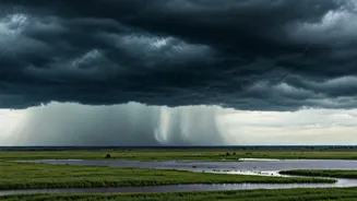
A red alert, for extremely heavy rainfall, has also been signalled for parts of Kerala and Coastal Karnataka for today. The weather agency predicts that these intense rainfall conditions will persist over the next several days. Widespread rainfall is expected to continue across the region until early July.
Areas Under Watch
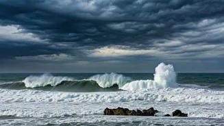
In Kerala, while Kannur and Kasaragod face an orange alert for Monday, a dozen other districts are under a yellow alert, signifying the likelihood of heavy rain (64.5 mm to 115.5 mm). These include Thiruvananthapuram, Kollam, Idukki, Ernakulam, and Kozhikode. The alert structure is dynamic, with districts like Kozhikode and Wayanad moving to an orange alert on Tuesday. In neighbouring Karnataka, the entire coastal and Malnad regions are on high alert. Rainfall is expected across Coastal, North Interior, and South Interior Karnataka, with warnings of strong surface winds accompanying the downpours. The warnings extend to fishermen, who are strongly advised not to venture into the sea off the coasts of Kerala and Karnataka due to squally weather and rough sea conditions.
Understanding the Warnings
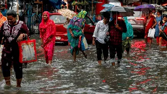
These alerts are more than just weather jargon; they are a call to action. 'Heavy rainfall' can lead to several civic issues, including localized flooding, waterlogging in low-lying areas, and traffic disruptions in major cities. 'Very heavy' or 'extremely heavy' rainfall significantly increases the risk of more severe events like flash floods and landslides, particularly in the hilly and vulnerable ghat sections of both states. The Kerala State Disaster Management Authority (KSDMA) has specifically cautioned those living in areas historically prone to such natural disasters to be ready for potential evacuation if instructed by local authorities.
Essential Safety Measures for Residents
Preparedness is key to navigating the heavy monsoon spell safely. It's crucial to stay informed through official channels like the IMD and local disaster management authorities. Avoid unnecessary travel, especially towards hill stations and areas with active warnings. At home, ensure you have an emergency kit with essentials like a torch, power bank, first-aid supplies, and dry food items. Secure loose objects outside your house that could be affected by strong winds. A critical piece of advice is to avoid contact with electrical wires and to stay away from waterlogged streets, which may hide open drains or pose an electrocution risk.
Impact on Travel and Commuting
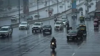
Heavy rains will almost certainly disrupt daily life and travel plans. Commuters should anticipate delays due to waterlogged roads and potential traffic diversions. Those planning long-distance travel by road or rail should verify their routes, as services can be delayed or rerouted. Authorities particularly advise against travel through landslide-prone ghat roads. Before heading out, check the real-time traffic updates and weather forecasts. If conditions seem severe, it is safest to postpone your journey. The KSDMA has urged the public to stay clear of rivers and other water bodies that can swell rapidly and unexpectedly.
Broader Monsoon Context
This bout of heavy rain in the south is part of the larger southwest monsoon pattern currently active across India. While the southern peninsula receives intense rainfall, the monsoon is also advancing into parts of North India, with conditions becoming favourable for its arrival in Uttar Pradesh and Uttarakhand over the next few days. However, the overall forecast for the 2026 monsoon season suggests a possibility of below-normal rainfall for the country as a whole, which raises concerns for agriculture in other regions. This makes the current downpour in Kerala and Karnataka a significant, regionally-concentrated weather event.