






An Ambitious Eye in the Sky
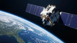
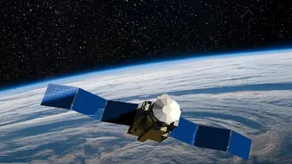
EOS-05 is an advanced Earth observation satellite developed by the Indian Space Research Organisation (ISRO). After a previous attempt with a similar satellite, EOS-03 (also known as GISAT-1), was lost due to a launch vehicle failure in August 2021, the successful
launch of EOS-05 on September 4, 2026, marks a major milestone. Dubbed the “Eye in the Sky,” its primary mission is to provide near real-time imaging of the Indian subcontinent, a capability that distinguishes it from most other observation satellites. Placed in a high geosynchronous orbit, it represents a significant leap forward, turning a long-held technological ambition into reality for India.
The Geostationary Advantage
What makes EOS-05 a game-changer is its orbit. Most Earth observation satellites are in Low Earth Orbit (LEO), circling the planet multiple times a day. While they capture high-resolution images, they can only view a specific location for a few minutes at a time. EOS-05, however, operates from a geostationary orbit, approximately 36,000 kilometres above the Earth's surface. At this altitude, its orbital speed matches the Earth's rotation, making it appear stationary from the ground. This unique positioning allows it to maintain a constant watch over a vast area, covering the entire Indian landmass and surrounding oceans, enabling continuous monitoring instead of intermittent passes.
A Quantum Leap for Disaster Management
The ability to provide continuous imagery has transformative implications for managing natural disasters. In a country prone to cyclones, floods, and forest fires, near-real-time monitoring is crucial. With EOS-05, authorities can track the formation and progression of cyclones, observe river levels to predict floods, and detect forest fires as they start. This constant stream of data dramatically reduces the time between a disaster's onset and the emergency response, allowing for quicker evacuations, better resource allocation, and more effective rescue operations. Instead of relying on scattered reports, response teams can work with a live, comprehensive view of the affected area.
Beyond Weather and Calamity
The applications of EOS-05 extend far beyond disaster response. Its powerful imaging instruments can monitor agriculture by assessing crop health, soil conditions, and water availability, providing invaluable data for improving yields and managing resources. It can also track changes in forest cover, monitor the health of glaciers and water bodies, and observe urban development. Furthermore, the satellite possesses significant strategic value. Its ability to provide persistent surveillance over border areas and maritime regions enhances India's national security capabilities, offering a crucial tool for monitoring assets and remote territories.
A Landmark Achievement for ISRO
The successful deployment of EOS-05 is a moment of redemption and a significant morale boost for ISRO, especially following the 2021 failure of its predecessor and other recent launch setbacks. The mission, launched aboard the GSLV-F17 rocket, not only places a vital asset in orbit but also validates the reliability of the launch vehicle's cryogenic upper stage, a key piece of technology. By overcoming past challenges, ISRO has finally delivered on a capability that was first envisioned years ago, reinforcing India's self-reliance and prowess in space technology.