





What is Cyclone Akvan's Current Status?
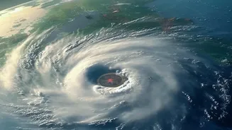
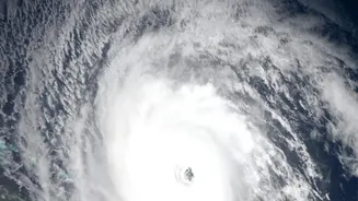
As of the latest bulletin on November 18, the India Meteorological Department has classified 'Akvan' as a Severe Cyclonic Storm. It was located over the west-central Bay of Bengal, approximately 610 km southeast of Machilipatnam and 610 km south-southeast
of Visakhapatnam in Andhra Pradesh. The system is moving slowly in a north-northwesterly direction. Forecasters are monitoring it closely, as conditions are favourable for further intensification. The name 'Akvan' was suggested by Iran as part of the regional naming convention for tropical cyclones.
The Official Forecast: Path and Landfall
The IMD predicts that Cyclone Akvan will continue to intensify, potentially becoming a Very Severe Cyclonic Storm by the morning of November 19. The current projected path shows the storm moving towards the Andhra Pradesh coast. Landfall is expected to occur around noon on November 20, likely between Nellore and Visakhapatnam. At the time of landfall, the system is anticipated to have maximum sustained wind speeds of 120-130 kmph, with gusts reaching up to 145 kmph. Residents should be aware that the exact track and intensity can change, making it essential to follow the very latest IMD updates.
Understanding the IMD's Colour-Coded Warnings
The IMD has issued a cyclone alert, marked as an 'Orange Message', for the coasts of Andhra Pradesh and adjoining south Odisha. It is crucial to understand what these colours mean. 'Yellow' advises you to 'Be Updated', as weather could worsen. 'Orange' means 'Be Prepared', as severe weather is likely, and you should anticipate disruptions like power cuts and make safety plans. A 'Red' alert means 'Take Action', as extremely bad weather is expected, and you must follow official orders, which may include evacuation. As Akvan approaches, these alerts for specific districts will be updated, so paying attention to the colour for your area is vital. Heavy to very heavy rainfall is forecast for coastal Andhra Pradesh and Yanam from November 19, with some areas potentially seeing extremely heavy rainfall.
Specific Advisories for Coastal and Marine Areas
Authorities have issued strict warnings based on the IMD forecast. The fisheries department has advised that all fishing operations in the Bay of Bengal be completely suspended. Fishermen already at sea are strongly urged to return to the coast immediately. Sea conditions are expected to become very rough to phenomenal, with wave heights potentially exceeding 14 metres (46 feet) from the night of November 19. For those in low-lying coastal areas, preparations for evacuation are underway in several districts, and residents should be ready to move to designated cyclone shelters if instructed by local officials. A storm surge of up to two metres above the normal tide is also possible at the time of landfall, which could inundate low-lying coastal areas.
How to Prepare: A Public Safety Checklist
As the storm system develops, preparedness is key to ensuring safety. The National Disaster Management Authority (NDMA) advises all residents in potentially affected areas to take proactive steps. Prepare an emergency kit with essentials like non-perishable food, drinking water, medications, torches, batteries, and a first-aid kit. Keep important documents like identity cards and property papers in a waterproof bag. Secure your home by fastening loose doors and windows. Stay indoors and away from coastal areas. Most importantly, avoid spreading or believing rumours, especially on social media. Rely exclusively on official information from the IMD, NDMA, and local district administration. You can access official alerts and interactive maps through the IMD's Mausam website and app.