


A Tsunami in the Sky
Instagram Reels and other social media platforms have been buzzing with clips showing what looks like a slow-motion tsunami made of clouds. These videos, captured by awestruck residents in various parts of Gujarat and Madhya Pradesh, depict a massive,
low-hanging, wedge-shaped cloud formation advancing ominously. The sheer scale and organised structure of the clouds have mesmerised viewers, with many describing the sight as both terrifying and beautiful. The scenes are a stark contrast to the scorching heat that preceded them, capturing the dramatic flair with which the 2026 monsoon season is making its presence felt. The virality of these clips speaks to a shared sense of wonder at the raw power of nature, turning a weather event into a collective digital experience.
The Science Behind the Spectacle
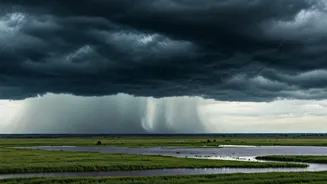
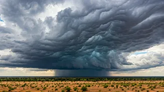
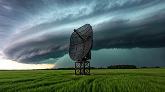
This stunning phenomenon is well-known to meteorologists as an arcus cloud, or more specifically, a shelf cloud. These are not clouds that form on their own, but rather are attached to the base of a powerful parent thunderstorm, often a cumulonimbus. Their dramatic, layered appearance is a direct result of the storm's internal dynamics. A shelf cloud forms on the leading edge of a thunderstorm as cool, sinking air from the storm’s downdraft spreads out across the land. This outflow of cold air acts like a wedge, forcing the warmer, moist air in its path to lift rapidly. As this warm air rises, it condenses into the distinct, shelf-like formation that has been filling up phone screens.
A Sign of an Advancing Monsoon
The appearance of these shelf clouds is a powerful and visual confirmation of the monsoon's advance into western and central India. According to the India Meteorological Department (IMD), conditions have been favourable for the Southwest Monsoon to progress into more parts of Gujarat and Madhya Pradesh. [11, 15, 18] After a prolonged dry spell and a stalled start in many parts of the country, the monsoon's revival is a welcome sight. [17] These clouds are the visible vanguard of this much-needed shift in weather. They carry the promise of rain that is crucial for the region's agriculture and for replenishing water reservoirs after a punishing summer. The IMD has forecast that rainfall activity is expected to intensify across these regions in the coming days. [10, 11, 16]
Beauty and a Warning
While visually stunning, a shelf cloud is also a clear warning sign. It marks the boundary of a gust front, which is the leading edge of strong, potentially damaging winds from the thunderstorm. Anyone who has seen one of these clouds up close will have experienced the sudden drop in temperature and the abrupt increase in wind speed that follows its passage. These are not benign, fluffy clouds; they are the precursors to intense weather, including heavy rain, strong winds, and lightning. [23] The awe they inspire should be coupled with caution. Local weather authorities often issue alerts when such storm systems are on the move, advising residents to take necessary precautions against the impending downpour and gusty winds.