



A New Partnership Watching Over India
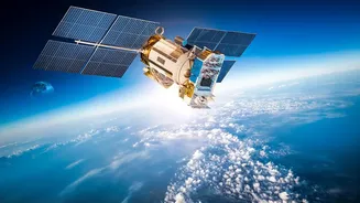
The NISAR (NASA-ISRO Synthetic Aperture Radar) mission is a landmark collaboration between the space agencies of the US and India. Launched in 2025, this advanced satellite is equipped with two powerful radar systems, L-band and S-band, making it the first
of its kind. Its primary goal is to systematically map our planet, measuring changes in land, ice, and ecosystems with remarkable precision. For India, one of its most anticipated applications is in agriculture, a sector that forms the backbone of the national economy and supports millions of livelihoods. The mission provides data that is openly available to the public, ensuring researchers and policymakers can access its insights.
Seeing Through Clouds, Day and Night
One of NISAR’s biggest advantages is its use of Synthetic Aperture Radar (SAR). Unlike optical satellites that need clear skies and daylight to capture images, radar can penetrate through clouds, rain, and smoke, and it works just as well at night. This is a game-changer for a country like India, where monsoon clouds can obscure vast agricultural regions for months. The ability to get a consistent, uninterrupted view of croplands throughout the entire growing season, especially during critical periods like planting and harvesting, has never been possible at this scale before. NISAR's data stream ensures that monitoring can continue regardless of weather conditions.
The Power of Daily Data Drops
While other satellites have monitored crops, NISAR’s frequency is what makes it revolutionary. The satellite images nearly all of Earth's land surfaces every 12 days. More importantly, the mission has now begun its daily release of processed images for key areas, including India's primary agricultural belts. This near-real-time flow of information allows for continuous tracking of crop development. Instead of getting a snapshot every few weeks, analysts can now observe the day-to-day changes in fields across the country. This high-frequency data provides fresh, actionable clues about how crops are responding to weather, irrigation, and other factors, enabling faster and more accurate assessments.
What the Radar Images Reveal
The clues from NISAR's radar images are incredibly detailed. The dual-frequency system can differentiate between various crop types and track their growth stages. For instance, the S-band radar is particularly effective at monitoring smaller vegetation like agricultural crops, while the L-band can assess biomass and soil moisture. The satellite can measure the physical structure of plants, helping to determine how healthy and developed they are. Crucially, it can also gauge the moisture content in both the soil and the plants themselves. Wetter soils reflect radar signals differently than drier soils, allowing scientists to create high-resolution maps of soil moisture at a 100-meter resolution, a vital indicator of drought risk or irrigation needs.
From Data to Decisions on the Farm
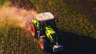
The ultimate goal is to turn this wealth of data into practical tools for farmers and policymakers. ISRO is already working with agricultural ministries to integrate NISAR's findings into national programmes. This data will enhance crop yield forecasting, giving the government a more accurate picture of future food supply. For farmers, it could lead to customised advisories on when to plant, how much to irrigate, and where to apply fertilisers. The data will also be invaluable for managing risk, as it allows for rapid and precise assessment of damage caused by floods, droughts, or pest attacks. This will improve the efficiency and fairness of crop insurance schemes and help direct disaster relief efforts more effectively.