






India’s Eyes in the Sky
The Indian Space Research Organisation (ISRO) operates a fleet of advanced Earth observation satellites that act as the nation's celestial weather reporters. At the forefront are the INSAT series, specifically INSAT-3D and INSAT-3DR, which are dedicated
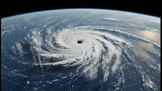
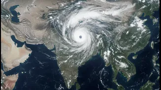
meteorological satellites. Launched in 2013 and 2016 respectively, these geostationary sentinels are positioned 36,000 kilometres above the Earth, maintaining a constant watch over the Indian subcontinent and the surrounding oceans. Their primary mission is to provide high-quality data for weather forecasting and disaster management. Working in tandem, these satellites can capture an image of the region every fifteen minutes, offering a near-real-time view of atmospheric changes. This constant surveillance is crucial for tracking the rapid development of weather systems like cyclones and thunderstorms.
More Than Just Cloud Pictures
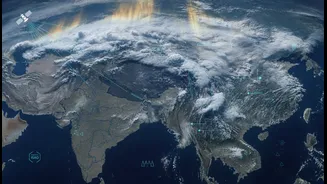
While the cloud-laced images of Earth from space are stunning, the data ISRO’s satellites collect is far more detailed. They are equipped with sophisticated instruments called imagers and sounders. The 6-channel imager captures images across different light spectrums, including visible, short-wave infrared, and thermal infrared. This allows it to monitor cloud cover, measure sea surface temperatures, and even detect low clouds and fog at night. The 19-channel sounder is even more remarkable. It measures the vertical profile of the atmosphere, providing crucial data on temperature and humidity at different altitudes, from the surface up to 70 kilometers. This three-dimensional understanding of the atmosphere is a game-changer for numerical weather prediction models, which are the backbone of modern forecasting. Essentially, the satellites provide a complete health check-up of the atmosphere, not just a surface-level snapshot.
From Satellite Data to Your Phone
Collecting the data is only the first step. The real magic happens through the collaboration between ISRO and the India Meteorological Department (IMD). ISRO gathers the raw satellite data, corrects it for any atmospheric distortions, and transmits it to the IMD. The IMD then feeds this high-quality data into its powerful supercomputers, which run complex numerical models. By assimilating this detailed satellite information on wind, temperature, and moisture, the models can create a more accurate initial picture of the current state of the atmosphere. A better starting point directly leads to a more reliable forecast. This synergy between space technology and meteorological science has significantly improved the accuracy of short to medium-range forecasts in India by an estimated 20-30%.
Making Forecasts Clearer for Everyone
The richness of ISRO's data is what empowers the move toward clearer public explainers. With more precise and localized information, the IMD can move beyond broad, district-level predictions. The goal is to provide hyper-local forecasts that are more relevant to daily life. Recently, advancements include new AI-powered systems that combine satellite observations with ground data to predict rainfall at a 1-kilometer resolution. This means forecasts can differentiate between weather in different parts of the same city. This enhanced precision allows for better communication. Instead of just saying “heavy rain expected,” forecasters can provide impact-based warnings, explaining what the weather will do—like waterlogging on specific routes or impact local farming activities. Better data also enables better visualizations, like detailed maps and animations, making the forecast easier for the public to understand and act upon.
A Direct Impact on the Ground
This technological leap has tangible benefits for millions. For farmers, who depend on the monsoon, more accurate predictions about its onset and distribution mean better decisions on when to sow, irrigate, and harvest. For urban residents, timely warnings about extreme rainfall can help mitigate the risks of flooding. For disaster management agencies, tracking the intensity and path of cyclones with greater accuracy saves countless lives through timely evacuations. ISRO’s data is also being used to develop systems for early prediction of lightning, a major hazard in India. By transforming a complex stream of atmospheric data into actionable intelligence, ISRO’s satellites are quietly becoming an indispensable part of India's climate resilience strategy.