

Seeing the Unseen Green
The most fundamental way satellites monitor vegetation is by measuring how plants reflect light. Healthy, thriving plants are rich in chlorophyll, the pigment that powers photosynthesis. Chlorophyll is excellent at absorbing red light but reflects near-infrared
(NIR) light, which is invisible to the human eye. Stressed, unhealthy, or sparse vegetation does the opposite—it reflects more red light and less NIR. Satellites equipped with special sensors can measure the amounts of red and NIR light reflecting off the planet's surface. By comparing the two, scientists can calculate a plant's 'greenness' or vigour. This data is often translated into a simple metric known as the Normalized Difference Vegetation Index (NDVI).
The Global Greenness Index
The NDVI formula—(NIR - Red) / (NIR + Red)—produces a value between -1 and +1. Dense, healthy vegetation like a thriving forest or a well-irrigated crop field will have a high positive value, close to +1. Conversely, areas with little or no vegetation, such as barren land, will have a value close to zero. Water bodies typically have negative values. By generating NDVI maps, researchers and agricultural bodies can get a snapshot of vegetation health across entire regions or even continents. In India, where agriculture is a massive part of the economy, this is transformative. It allows for monitoring millions of small farms simultaneously, something impossible with on-the-ground surveys alone. This data helps in forecasting crop yields, managing resources, and providing early warnings for potential issues.
Listening to Plants Photosynthesize
While NDVI is a powerful tool for measuring plant greenness, a more advanced technique offers a direct window into the process of photosynthesis itself. As plants absorb sunlight, they re-emit a tiny fraction of that energy as a faint glow, invisible to the naked eye. This phenomenon is called Solar-Induced Fluorescence, or SIF. This faint signal is a direct byproduct of photosynthetic activity. A strong SIF signal indicates that a plant is actively and efficiently converting light into energy. Detecting this incredibly subtle glow from space is a major technological feat, accomplished by highly sensitive spectrometers on satellites like NASA's Orbiting Carbon Observatory (OCO) series. SIF data allows scientists to measure plant productivity in real-time, providing a more accurate indicator of plant health and stress than greenness alone.
Measuring Thirst from Orbit
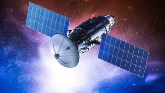
A plant can look green but still be in trouble due to a lack of water. To get a complete picture, satellites also need to measure moisture. This is where microwave signals come in. Unlike visible and infrared light, which are blocked by clouds, L-band microwave signals can penetrate cloud cover and even the top layer of soil. Missions like NASA’s Soil Moisture Active Passive (SMAP) satellite are designed specifically for this purpose. The satellite sends out microwave pulses and measures the signals that return. The amount of water in the soil changes how these microwaves are emitted and reflected; drier soil emits more microwave energy, while wetter soil emits less. This allows SMAP to create global maps of soil moisture in the top 5 centimetres of the ground with remarkable accuracy, covering the entire planet every two to three days.
From Data to Decisions in India
For a country like India, this satellite-based intelligence is a game-changer. Remote sensing provides an essential vantage point for monitoring India's vast and varied agricultural landscape. Programmes like FASAL (Forecasting Agricultural output using Space, Agro-meteorology and Land-based observations) use a combination of satellite data to generate pre-harvest production estimates for major crops across hundreds of districts. This information is crucial for everything from ensuring food security to guiding policy. By combining NDVI for vegetation health, SIF for productivity, and SMAP for soil moisture, authorities can monitor for agricultural drought, predict floods, and help farmers make more informed decisions about irrigation and fertilization. This space-age technology provides an invaluable tool for sustainably managing resources and improving crop yields for millions of smallholder farmers.