





A Disappointingly Dry Month
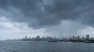
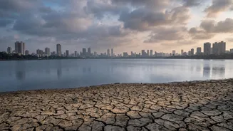
The numbers confirm what residents have been feeling all month: August has been unusually dry. While the season started with a delayed monsoon in June followed by a deluge in July that brought lake levels up, August failed to deliver. As of August 27,
the city has recorded significantly less rainfall than its monthly average. For instance, one of the city's primary weather stations, Santacruz, has registered just over 300 mm of rain, a fraction of what it received in August of the previous year. This stark deficit across the region has contributed to India's overall monsoon rainfall being 13% below normal for the season so far.
The View from the Lakes
Despite the poor August showing, the city's water supply isn't in immediate crisis, thanks to the heavy rainfall in July. As of August 27, the seven lakes that supply Mumbai with drinking water hold a collective stock of about 95.8%. While this figure provides a comfortable cushion, it is slightly lower than the same period last year. However, officials at the Brihanmumbai Municipal Corporation (BMC) are exercising caution. A 10% water cut implemented earlier in the season, when lake levels were dangerously low, remains in place as a precautionary measure. The decision reflects an awareness that with a full month of the monsoon season left, and forecasts remaining uncertain, conserving the current supply is the most prudent course of action.
The Science Behind the Silence
So, why did the vigorous monsoon of July fizzle out in August? Meteorologists point to a combination of factors. A weather system that was expected to draw moisture from the Arabian Sea toward the Konkan coast did not strengthen sufficiently. The India Meteorological Department (IMD) had already forecast a below-normal monsoon for the country in August and September. These extended 'break' periods, or rainless stretches, are becoming a more frequent feature of India's monsoons, leading to high variability where long dry spells are punctuated by short, intense bursts of rain.
El Niño's Long Shadow
The most significant global factor influencing this year's monsoon is the El Niño phenomenon. El Niño is a climatic pattern characterized by the warming of sea surface temperatures in the central and eastern Pacific Ocean, which can disrupt weather systems worldwide. For India, it is often associated with suppressed monsoon rainfall. The IMD has noted that El Niño conditions are strengthening and are expected to persist through the remainder of the monsoon season. This global pattern is seen as a primary driver behind the overall deficit this year, which could make 2026's monsoon the weakest since the major drought year of 2009.
An Anxious Look to September
With August providing little relief, all eyes are now on September, the final month of the official monsoon season. The IMD's extended forecast suggests that rainfall over peninsular India is likely to remain below normal in the coming week. While some light to moderate showers are expected over the Konkan coast, a major revival that would significantly boost rainfall statistics seems unlikely in the immediate future. The subdued forecast has implications not just for Mumbai's water reserves but also for agriculture across the country, as the performance in the final month is crucial for the overall success of the Kharif sowing season.