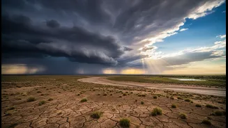









The Usual Suspect: What Is El Niño?
First, let's be clear: El Niño is a major player in global weather. It’s a natural climate pattern marked by the unusual warming of sea surface temperatures in the central and eastern Pacific Ocean. This warming is powerful enough to shift atmospheric
circulation across the globe. For India, this typically means trouble. Normally, trade winds push warm, moist air towards Asia, feeding the monsoon. During an El Niño, these winds weaken, and the atmosphere's 'rain engine' shifts away from the Indian subcontinent, increasing the chances of a drier-than-normal season. Historically, about 60% of El Niño years have resulted in below-average rainfall for India, and most major droughts have coincided with an El Niño event.
The Indian Ocean's Own Game-Changer
The Pacific Ocean isn't the only one with a say. The Indian Ocean has its own powerful climate phenomenon called the Indian Ocean Dipole, or IOD. Think of it as a climate see-saw. In its 'positive' phase, the western part of the Indian Ocean near Africa becomes warmer than the eastern part near Indonesia. This temperature difference creates a powerful local effect. The warmer water in the Arabian Sea increases evaporation and moisture, and stronger winds push that rain-filled air directly towards India. A strong positive IOD can act as a crucial counterforce, effectively overriding El Niño's drying influence and delivering a healthy monsoon. This is precisely what happened in 1997, when one of the strongest El Niños on record was neutralized by a positive IOD, resulting in above-average rains for India.
More Than One Player in the Atmosphere
The monsoon is a complex system with multiple influences. Beyond El Niño and the IOD, other atmospheric patterns also play a role. One such factor is the Madden-Julian Oscillation (MJO), a large, eastward-moving pulse of clouds and rainfall that travels around the tropics every 30 to 60 days. When the MJO is in its active phase over the Indian Ocean, it can significantly enhance monsoon rainfall and even trigger its onset. Conversely, its suppressed phase can lead to breaks in the monsoon. Even factors like snow cover over Eurasia can have an impact; lower snow cover can lead to a warmer subcontinent, intensifying the monsoon's circulation. The final outcome of the monsoon depends on the delicate and often unpredictable interplay of all these systems.
When History Defied the Forecast
The a-historic record is filled with examples that prove El Niño is not a guaranteed drought sentence. While many severe droughts are linked to El Niño, several El Niño years have bucked the trend. The 1997-98 season is the classic case, where a super El Niño was expected to cause a catastrophic drought, but India ended up with 2% above-normal rainfall thanks to a strong positive IOD. Similarly, 1983 and 1994 were strong El Niño years that still produced above-average rainfall in India. These instances highlight that while El Niño certainly loads the dice in favour of a weaker monsoon, it doesn't hold all the cards. The regional power of the Indian Ocean can, in many years, prove to be the monsoon's saving grace.