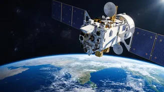









An Unblinking Eye in Geosynchronous Orbit
On September 4, 2026, the Indian Space Research Organisation (ISRO) successfully launched the Earth Observation Satellite-05 (EOS-05) from Sriharikota. Unlike previous observation satellites that orbit the Earth in lower orbits and revisit a location
periodically, EOS-05 is India’s first imaging satellite placed in a geosynchronous orbit, approximately 36,000 kilometres high. This specific orbit allows it to move in sync with the Earth's rotation, enabling it to continuously monitor the entire Indian subcontinent. This capability for persistent observation means it can track rapidly developing events, a crucial advantage when every minute counts. The satellite can image the entire Indian landmass roughly every 30 minutes, providing a stream of data that was previously unattainable.
The Power of Near Real-Time Monitoring
For a nation that frequently battles floods, cyclones, and forest fires, timely information is the most critical asset. Satellites have long been part of India's disaster management strategy, used for everything from cyclone tracking to drought assessment. However, the challenge has often been the delay between when a satellite captures an image and when that data becomes actionable information for teams on the ground. EOS-05 directly addresses this by providing near real-time imagery. This allows authorities to watch a cyclone's formation, track a flood's spread, or identify the exact location of a forest fire as it happens. For disaster response agencies like the National Disaster Management Authority (NDMA), this constant feed of information is invaluable for issuing timely warnings and planning evacuations.
Seeing Through the Storm
One of the most significant challenges during a monsoon-related disaster is cloud cover. Traditional optical satellites cannot see through clouds, rain, or the dark of night, which is precisely when monitoring is most needed. While EOS-05 is primarily an advanced optical and infrared imaging satellite, it joins a constellation of other ISRO satellites that possess all-weather capabilities, like those equipped with Synthetic Aperture Radar (SAR). SAR technology is a game-changer because it uses microwave signals that can penetrate clouds and darkness, providing clear images regardless of weather conditions. This technology is instrumental in mapping the true extent of flooding under heavy monsoon clouds or assessing landslide-prone slopes before and after heavy rainfall, ensuring that response efforts are based on accurate, current ground reality.
From Data to Life-Saving Decisions
The satellite itself is only one part of the disaster management chain. The true test of its effectiveness lies in how quickly its data can be processed and delivered to decision-makers in a district control room or a state disaster response force (SDRF). ISRO works closely with agencies to ensure that satellite inputs are integrated into platforms like the Bhuvan geoportal and the National Database for Emergency Management (NDEM). The launch of EOS-05 strengthens this entire ecosystem. By providing a higher frequency of high-quality images, it allows for quicker damage assessment after a disaster, helping officials identify which roads are cut off, which villages are inundated, and where relief supplies are needed most urgently. This helps in optimizing the deployment of rescue teams and resources, potentially saving countless lives.