



A New Sentinel in the Sky
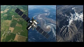
NISAR, short for NASA-ISRO Synthetic Aperture Radar, is a cutting-edge Earth-observation satellite born from a unique international alliance. Its primary objective is ambitious yet simple: to track the subtle and significant changes happening on our planet’s
surface with stunning precision. From the slow creep of a Himalayan glacier to the sudden ground shift before a landslide, NISAR is designed to see it all. Launched in mid-2025, the satellite is now orbiting the Earth every 12 days, gathering data that will help scientists understand climate change, manage resources, and respond to natural disasters with far greater speed and accuracy. This isn't just another satellite; it's a dedicated watchdog for Earth's complex systems, providing a continuous stream of information that was previously impossible to collect on such a massive scale.
A Landmark Partnership
The collaboration behind NISAR is as impressive as its technology, representing one of the most significant partnerships ever forged between the Indian Space Research Organisation (ISRO) and NASA. In this joint effort, each agency brought its best to the table. NASA provided the L-band SAR payload—the instrument responsible for deep-penetrating radar imagery—along with a high-speed data communication system. ISRO contributed the S-band SAR payload, which offers complementary surface data, as well as the spacecraft bus and the powerful GSLV rocket that carried the world's most expensive Earth-imaging satellite into orbit from Indian soil. This division of labour created a truly integrated and formidable system, a testament to what international cooperation in space can achieve for the benefit of all on Earth.
The All-Seeing Radar Eye
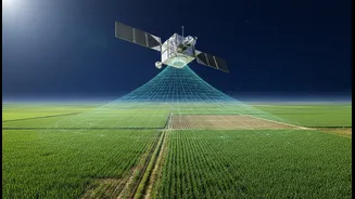
What makes NISAR so special is its use of Synthetic Aperture Radar, or SAR. Unlike traditional optical satellites that are essentially cameras in space, SAR is a powerful radar system that can "see" regardless of weather or time of day. This is a game-changer, especially for a country like India. During the crucial monsoon season, when vast swathes of the country are covered by clouds, optical satellites are rendered blind. SAR, however, penetrates clouds, fog, and darkness, providing an uninterrupted view of the ground below. This means authorities can monitor flooding, assess crop damage, or track cyclones in real-time, even in the worst weather conditions. It provides a reliable, all-weather, 24/7 observation capability that is critical for effective disaster management and agricultural planning.
Unprecedented Detail and Frequency
NISAR’s vision is not only all-weather but also incredibly detailed and frequent. The mission is the first to use two different radar frequencies (L-band and S-band) simultaneously, which allows it to observe a wider range of changes on the Earth's surface with incredible precision. The L-band can penetrate forests to see the ground, while the S-band is excellent for monitoring crop health and soil moisture. The satellite scans nearly the entire globe every 12 days, creating a time-lapse view of the planet that can detect changes as small as a centimeter. This rapid revisit time allows scientists to spot subtle trends that might otherwise be missed, offering clues about impending landslides, volcanic activity, or the depletion of groundwater. This combination of dual-frequency observation and repeating coverage gives scientists an unprecedented dataset to study Earth’s dynamic processes.
A Game-Changer for India
For India, the data from NISAR is nothing short of transformative. The applications are vast and directly address some of the nation’s most pressing challenges. In agriculture, the S-band radar, developed by ISRO, will be invaluable for monitoring crop health, assessing soil moisture, and predicting yields, thereby bolstering food security. For disaster management, the ability to see through clouds will revolutionize how agencies respond to floods and cyclones, allowing for damage maps to be created within hours. The mission will provide critical data on the melting of Himalayan glaciers, which are a vital water source for millions. It will also help in managing groundwater resources, monitoring coastal erosion, and tracking deforestation. NISAR gives India a powerful, sovereign tool to build climate resilience, manage its natural resources sustainably, and protect its citizens more effectively.