

An Eye in the Sky for Earthly Dangers
India's diverse geography makes it vulnerable to numerous natural disasters, including floods, cyclones, landslides, droughts, and earthquakes. For decades, disaster management was primarily a reactive process, with authorities scrambling to respond after
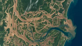
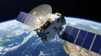
an event occurred. Satellite technology is fundamentally changing this paradigm. By providing a synoptic view of vast, often inaccessible areas at regular intervals, satellites empower a shift towards proactive and data-driven disaster management. This 'eye in the sky' can monitor changing weather patterns, water levels, and ground stability, providing crucial information before, during, and after a crisis.
ISRO's Crucial Role in National Safety
The Indian Space Research Organisation (ISRO) is at the heart of this technological shift. Through its comprehensive Disaster Management Support (DMS) Programme, ISRO provides near real-time satellite data to central and state agencies. A constellation of satellites, including the INSAT series for weather, the IRS series for resource imaging, and high-resolution mappers like Cartosat and RISAT, form the backbone of this system. This data is processed and disseminated through dedicated portals like Bhuvan and the National Database for Emergency Management (NDEM), giving disaster managers actionable intelligence. For instance, the National Remote Sensing Centre (NRSC) in Hyderabad acts as the nodal agency, capable of generating damage assessment maps within 24 to 48 hours of a major event.
From Cyclone Warnings to Flood Mapping
The applications are tangible and life-saving. For cyclones, meteorological satellites like INSAT-3D and 3DR provide constant updates on storm formation, intensity, and path, allowing the India Meteorological Department (IMD) to issue warnings with a lead time of three to five days. In the case of floods, which plague vast parts of the country, satellites map inundated areas, helping to plan rescue and relief operations effectively. Flood early warning systems that combine satellite rainfall forecasts with ground models can now predict flooding up to 52 hours in advance. For the Himalayan region, ISRO monitors over 18,000 glacial lakes for risks of outburst floods and tracks landslide-prone zones. Even agricultural drought is monitored through satellite assessments of soil moisture and vegetation health.
Next-Generation Technology and Global Collaboration
The future lies in even faster and more precise data. Innovations from both government and private players are pushing the boundaries. Start-ups are developing 'thinking' satellites with onboard processing that can analyze images in orbit, drastically cutting down the time it takes to deliver usable insights to ground teams. A notable advancement is the development of satellites combining optical and Synthetic Aperture Radar (SAR) technology, which can see through clouds and darkness, ensuring all-weather, day-and-night monitoring. Furthermore, India is a key player in international collaboration. The joint NASA-ISRO Synthetic Aperture Radar (NISAR) mission will measure changes in Earth's surface with unprecedented detail, enhancing our understanding of earthquakes and landslides. ISRO is also a founder member of the International Charter 'Space & Major Disasters', a global effort to provide satellite data for disaster response.
Challenges on the Path to Resilience
Despite significant progress, challenges remain. A primary hurdle is the last-mile delivery of data—ensuring that the sophisticated information generated by satellites is accessible and usable for local-level decision-makers. This involves continuous capacity building and training for state and district officials. Another challenge is reducing the time lag between data capture and analysis, as every minute counts during an emergency. While technology is advancing rapidly, integrating these complex data streams into a unified and seamless response system across various government departments requires sustained effort and investment. Making high-resolution data from indigenous satellites more openly available could also spur further innovation and research.