







Cyclone Akvan: The Latest Forecast
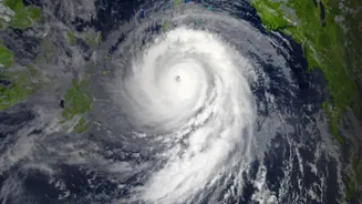
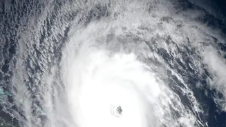
The India Meteorological Department (IMD) is closely monitoring Cyclonic Storm Akvan, which formed over the Bay of Bengal and intensified from a deep depression on November 16, 2026. As of the morning of November 18, the system has strengthened into a Severe
Cyclonic Storm and is located over the west-central Bay of Bengal. It is moving in a north-northwestward direction. The IMD forecasts it will continue to intensify into a Very Severe Cyclonic Storm by the evening of November 19. The storm is projected to cross the Andhra Pradesh coast between Nellore and Tuni around noon on November 20. The name 'Akvan' was contributed by Iran as part of the regional naming convention for tropical cyclones.
What 'Very Severe' Classification Means
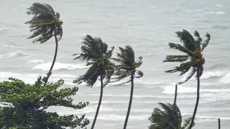
The IMD uses a specific scale to classify the intensity of cyclones. A 'Very Severe Cyclonic Storm' (VSCS) is a powerful system characterized by sustained wind speeds of 118 to 165 kilometres per hour. Cyclone Akvan is expected to make landfall with maximum sustained winds of 120-130 km/h, with gusts reaching up to 145 km/h. Winds of this speed can cause significant damage to infrastructure, including uprooting trees, damaging kutcha houses, and disrupting power and communication lines. In addition to the fierce winds, a major threat is a storm surge—a temporary rise in sea level. The IMD has warned of a possible storm surge of 1 to 2 metres above the normal tide, which could inundate low-lying coastal areas of several districts in Andhra Pradesh.
Areas Under Alert
The primary areas of concern are along the Andhra Pradesh coast, for which the IMD has issued an Orange alert, signifying a need to be prepared. The districts of Prakasam, Bapatla, Krishna, West Godavari, Konaseema, Kakinada, and Visakhapatnam are expected to be most affected by heavy rainfall, strong winds, and the storm surge. Adjoining southern coastal areas of Odisha are also on alert, with forecasts of heavy rainfall from November 19 to 21. Furthermore, the cyclone's influence is expected to bring rainfall to parts of Telangana, Tamil Nadu, and even West Bengal. Authorities in all potentially affected states are on high alert.
Official Safety and Preparedness Guidelines
The National Disaster Management Authority (NDMA) and IMD have issued clear guidelines for public safety. The foremost advice is for fishermen, who have been strictly warned not to venture into the Bay of Bengal until the storm has passed. Residents in coastal areas, particularly in kutcha houses or low-lying regions, are advised to move to designated cyclone shelters. It is crucial to have an emergency kit ready with essentials like non-perishable food, drinking water, medicines, torches, and batteries. Stay indoors during the cyclone and away from windows. Do not believe rumours; rely only on official announcements from the IMD and local authorities for information. Keep mobile phones charged to stay updated and in touch.
How Authorities Are Preparing
State and central agencies are on high alert. The Andhra Pradesh government has reviewed preparations, focusing on evacuating vulnerable populations and ensuring fishing boats return to shore. The National Disaster Response Force (NDRF) has deployed teams to coastal districts to assist with evacuation and rescue operations. Emergency Operation Centres are being activated at state and district levels to coordinate the response. In Odisha, the government has prepared rescue teams and identified landslide-prone villages for potential evacuation as a precautionary measure due to the heavy rainfall forecast. These coordinated efforts aim to minimize the loss of life and property, reflecting a significant improvement in India's disaster management capabilities over the years.