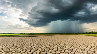


A Much-Needed Reprieve from the Heat
The oppressive heat that has gripped Purvanchal, encompassing cities like Varanasi, Gorakhpur, and Prayagraj, has finally broken. For weeks, residents endured a severe heatwave, with temperatures consistently hovering between 40°C and 43°C. The India
Meteorological Department (IMD) had issued persistent heatwave warnings for the region, noting that maximum temperatures were markedly above normal. This recent shift has seen a noticeable drop in daytime heat, bringing long-awaited comfort. Forecasts now show increased cloud cover and a higher chance of rain in the coming days, signaling a definitive end to the punishing dry spell.
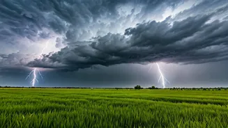
The Science of the 'Purvaiya'
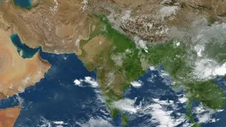
The hero of this story is the ‘Purvaiya’, the local name for the moist, easterly winds that blow from the Bay of Bengal. Unlike the dry, hot westerly winds (known as 'pachua') that originate over the hot plains of Pakistan and Rajasthan, the easterlies carry significant moisture. This influx of moisture increases humidity but also brings cloud cover and, eventually, rain. This change disrupts the hot, dry conditions that allow heatwaves to build and persist. The arrival of the Purvaiya is a classic indicator that the atmospheric conditions are becoming favourable for the advance of the southwest monsoon into the Gangetic plains.
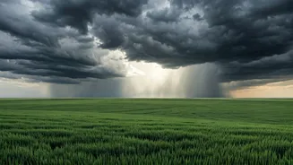
Surviving a Brutal Summer
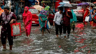
The relief is palpable because the preceding heatwave was exceptionally severe. Cities across East UP were among the hottest in the country on several days in June. The IMD had warned of “severe heat wave conditions,” a classification reserved for particularly intense and prolonged heat. This wasn't just a matter of discomfort; it posed a significant health risk, prompting concerns for vulnerable populations like the elderly and infants. The state government even prepared a 'heat action plan' for schools, advising them to suspend outdoor activities and ensure constant availability of drinking water and ORS. The combination of extreme daytime heat and unusually warm nights offered little to no respite for residents.
A Precursor to the Monsoon
This shift in wind direction is more than just a temporary cooldown; it's a crucial sign that the monsoon is finally approaching. The IMD has stated that conditions are favourable for the southwest monsoon to advance into parts of Uttar Pradesh over the next few days. Weather scientists and forecasters anticipate that the monsoon will become active across the entire state by the first week of July, bringing widespread rainfall. The easterly winds are essentially laying the groundwork, creating the moist atmospheric highway that the monsoon trough will travel along. The forecast points towards a significant increase in rainfall activity starting around June 30th, which is expected to cause a further drop in temperatures by several degrees.
Cautious Optimism for the Rains Ahead
While the immediate relief is welcome, all eyes are on the performance of the monsoon itself. The season has been delayed in its northward progression, and initial long-range forecasts from the IMD had suggested the possibility of a below-normal monsoon for the country this year, partly due to developing El Niño conditions. Farmers, in particular, are anxious for a good spell of rain to aid in the sowing of kharif crops, which has been slowed by the dry conditions. The arrival of these pre-monsoon showers and the cooling effect of the easterly winds provide a crucial window of opportunity and a powerful dose of hope for the agricultural heartland of Uttar Pradesh.