



The Post-Monsoon Paradox
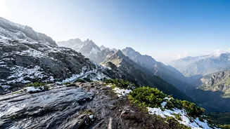
September to November is traditionally a prime trekking season. The monsoon rains have washed away dust, leaving behind lush greenery and crystal-clear mountain views. However, changing climate patterns mean the monsoon often lingers, bringing unexpected
storms, and the aftermath can leave trails in a precarious state. Trekkers face a paradox: some of the best views of the year, coupled with significant risks like slippery paths, swollen streams, and the potential for landslides on terrain destabilized by heavy rains. Routes that were safe a decade ago may now have unpredictable sections, making historical data less reliable.
Understanding Your Digital Safety Net
Weather safety trackers are more than just the forecast app on your phone. For remote Himalayan travel, these tools fall into two critical categories: official meteorological alerts and personal satellite communication devices. Government bodies like the India Meteorological Department (IMD) provide regional forecasts, warnings for heavy rain or snow, and specialised bulletins for pilgrimages and tourism. These are essential for pre-trip planning. For on-the-trail safety beyond mobile network coverage, Personal Locator Beacons (PLBs) and satellite messengers are vital. These devices use satellite networks to transmit your location or send messages from areas where phones cannot.
Satellite Messengers vs. Personal Locator Beacons
Choosing the right device depends on your needs. A Personal Locator Beacon (PLB) is a one-way emergency device. When activated, it sends a distress signal with your GPS coordinates to international rescue services via the Cospas-Sarsat satellite system. They are simple, often have a long battery life, and typically don't require a subscription. Satellite messengers, like the popular Garmin inReach or ZOLEO devices, offer two-way communication. They allow you to send and receive text messages, share your location with family, receive weather updates, and trigger an SOS alert in an emergency. This two-way capability is invaluable for confirming details of an emergency or simply checking in. However, these devices require an active subscription plan to function.
Navigating Regulations in India
It is crucial for travellers to understand that India strictly regulates the use of satellite communication devices. Carrying and operating a satellite phone or a two-way messenger like a Garmin inReach without a prior permit from the Department of Telecommunications is illegal and can lead to confiscation and legal trouble. While some trekkers registered with authorized bodies like the Indian Mountaineering Foundation may be granted permission for emergency use, individual tourists must research the latest regulations thoroughly. Devices that only receive signals, like a standard GPS unit for navigation, are generally permitted. Always verify the current laws before bringing any satellite transmission device into the country.
Integrating Technology into Your Trek Plan
A tracker is not a substitute for preparation. Before you leave, download offline maps to your phone or GPS unit. Study the IMD's 7-day forecasts and any specific advisories for your route. If using a satellite messenger, schedule regular check-in times with a contact back home so they know when to expect a message. Conserve battery by turning the device off at night or using power-saving tracking intervals. Most importantly, pair your technology with common sense. Inform your guide and travel partners of your communication plan, understand the device's limitations, and always be prepared to turn back if weather conditions deteriorate, regardless of what a forecast might have promised.