






A New Guardian in the Sky
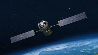
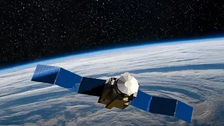
The Indian Space Research Organisation (ISRO) has enhanced its space-based surveillance capabilities with the launch of a new-generation Earth observation satellite, part of its advanced geo-imaging satellite series. This is not just another satellite;
it's a dedicated sentinel placed in a geostationary orbit. Unlike polar-orbiting satellites that pass over a location only a couple of times a day, this 'space eye' orbits at the same speed as the Earth's rotation. This synchronisation allows it to remain seemingly fixed over the Indian subcontinent, providing continuous, real-time monitoring of a vast region—a critical advantage for tracking rapidly developing weather events.
The Technology Onboard
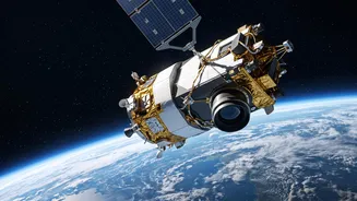
At the heart of this new satellite are its sophisticated instruments, designed to capture a detailed picture of the atmosphere. It carries an advanced imager that can see in multiple spectral bands, including visible and infrared light. This allows it to monitor cloud formation, measure sea surface temperatures, and even detect smoke from forest fires day and night. It is also equipped with an atmospheric sounder, which measures temperature and humidity at different altitudes. This helps create a three-dimensional profile of the atmosphere, providing crucial data for weather prediction models. The ability to deliver high-resolution imagery frequently—in some cases, as often as every five to ten minutes for specific areas—is a significant leap from previous capabilities.
Revolutionising Cyclone Warnings
For a country with a long and vulnerable coastline, the most significant impact of this satellite will be on cyclone forecasting. Historically, predicting the exact path and, more importantly, the intensity of a tropical cyclone has been a major challenge. With its ability to provide uninterrupted observation, the new satellite allows meteorologists to watch a storm evolve from its nascent stages. They can animate sequences of images to better track the storm's movement and analyse its structure for signs of intensification. This continuous stream of data leads to more accurate predictions of a cyclone's landfall location and strength, providing disaster management agencies with precious extra hours or even days to carry out effective evacuations and save lives.
Beyond the Daily Forecast
While improved weather forecasts are a primary benefit, the satellite's applications extend much further. For India's vast agricultural sector, the data is invaluable. It can help monitor crop health, assess soil moisture levels, and provide inputs for more efficient irrigation, leading to better yields. During a natural disaster, be it a flood, forest fire, or drought, the satellite provides near real-time imagery that helps authorities assess the extent of the damage and coordinate relief efforts more effectively. The data also supports aviation by offering clearer information on atmospheric conditions, and helps monitor changes in land use, water bodies, and glacial lakes.
Part of a Bigger Picture
This satellite is a key component of ISRO's broader strategy to create a comprehensive Earth observation network. It complements the existing fleet of Indian Remote Sensing (IRS) satellites, including the INSAT series, which have been the backbone of India's meteorological services for decades. By developing and deploying such advanced technology, India reinforces its position as a major space power and enhances its self-reliance in critical areas like climate resilience and national security. The data from this satellite, when integrated with information from other platforms like the Cartosat mapping satellites, provides a holistic view of the nation's land, water, and atmospheric resources.