




The Upstream Blockage Problem
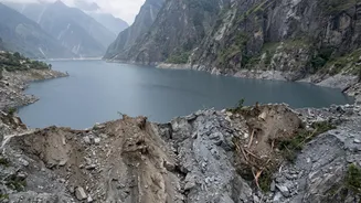
The primary and most immediate threat comes from an unstable blockage that remains lodged upstream in the river system along the Nepal-China border. The initial, devastating flood on August 26 was triggered when a massive ice-and-rock avalanche created
a temporary dam on the Lende Khola, a tributary of the Bhote Koshi river. When this dam catastrophically failed, it released a wall of water, mud, and boulders. Experts from the International Centre for Integrated Mountain Development (ICIMOD) and other agencies have warned that a significant blockage still persists. This remaining natural dam is holding back an unknown volume of water. If it breaches, it could trigger a second flood wave, potentially with little to no warning. Authorities have issued evacuation orders for areas like the Jilong port due to this specific, imminent threat.
Reading the Rivers and Rain
While the first flood was not caused by rainfall, the ongoing monsoon season dramatically complicates the situation. Experts at Nepal's Department of Hydrology and Meteorology (DHM) are constantly monitoring river levels and rainfall forecasts. Even moderate rainfall can now pose a significant threat for two key reasons. Firstly, the ground in the Himalayan region is already saturated from previous rains and the initial flood, increasing the likelihood of further landslides. Secondly, any additional water flowing into the river system adds pressure to the unstable upstream blockage, increasing the chance of its failure. Hydrological stations are crucial, but some were damaged or washed away in the first surge, creating blind spots in the monitoring network. Water levels on the Trishuli River at one point rose by nine metres in just 30 minutes, showing how quickly conditions can change.
Cascading Hazards: From Glaciers to Floods
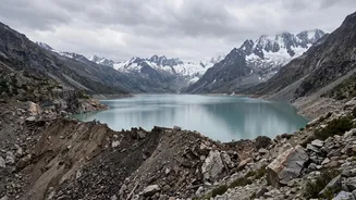
The assessment goes beyond just rivers and rain; it involves monitoring the cryosphere—the frozen parts of the Himalayas. The initial event is believed to have been a complex chain reaction, or a 'cascading hazard'. An earthquake may have triggered an ice-rock avalanche, which then blocked the river. This highlights the multiple, interconnected risks in the region. Scientists point out that climate change is increasing the frequency of such events. Warmer temperatures are leading to the retreat of glaciers and the destabilisation of high-altitude slopes, making avalanches more likely. Another major concern is the risk of Glacial Lake Outburst Floods (GLOFs), where melting glaciers form large, unstable lakes that can burst without warning. The August 26 event shared characteristics with a GLOF, and assessing the stability of other glacial lakes in the region is a key part of long-term risk analysis.
The Challenge of Transboundary Data
A critical, and often difficult, part of the assessment relies on international cooperation. Since the flood originated on the Nepal-China border, data from the Chinese side is essential for accurate forecasting. Nepalese officials and international experts have repeatedly highlighted the need for a robust, real-time data-sharing mechanism. Information about river levels, rainfall, and geological instability in the upper reaches of the river system in Tibet is vital for providing timely warnings to downstream communities in Nepal. Following a similar, smaller flood in 2025, Nepal committed to strengthening coordination with China. However, experts note that getting this information quickly and reliably during a crisis remains a major challenge. Without it, forecasters in Nepal are working with an incomplete picture, making it harder to predict the timing and magnitude of a potential second wave. This risk extends further downstream, with authorities in the Indian states of Bihar and Uttar Pradesh also on alert for a potential surge in the Gandak River.