




A Landmark Partnership in Orbit
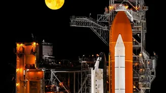
The NASA-ISRO Synthetic Aperture Radar (NISAR) mission is a monumental collaboration between the two space agencies, representing one of the most significant joint hardware development projects for an Earth-observing satellite. Launched from India's Satish
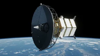
Dhawan Space Centre on July 30, 2025, NISAR is arguably the world's most expensive Earth-imaging satellite, with a total cost estimated at $1.5 billion. Its primary goal is to conduct a comprehensive survey of our planet, observing and measuring some of Earth's most complex natural processes. This includes monitoring ecosystem disturbances, tracking the collapse of ice sheets, and studying natural hazards like earthquakes and volcanoes. The mission is a testament to the growing strategic partnership, with ISRO providing the spacecraft bus, the S-band radar, and the GSLV launch vehicle, while NASA supplied the L-band radar and a massive 12-metre reflector antenna.
The All-Seeing Radar Eye
What makes NISAR truly groundbreaking is its dual-frequency radar system. It is the first satellite mission to use two different radar frequencies, L-band and S-band, to map the entire globe. This Synthetic Aperture Radar (SAR) technology allows the satellite to see through clouds and operate day or night, providing an uninterrupted stream of data. By capturing images every 12 days, NISAR can detect changes on the Earth's surface as small as a single centimeter. This incredible precision enables scientists to track subtle but critical shifts, from the movement of glaciers to land subsidence caused by groundwater changes. NASA's L-band radar is designed for deeper penetration, while ISRO's S-band offers higher-resolution surface imaging, a combination that provides a uniquely detailed view of our dynamic planet.
Antarctica's 'Hummingbird' Revealed
Recent data released from the mission includes a stunning radar image from East Antarctica that has been nicknamed "the hummingbird" by scientists. The image shows a rocky mountaintop, known as Nunatak Zaterjavshijsja, poking through the ice sheet. As the vast stream of ice flows around this obstacle, it becomes heavily fractured with deep cracks called crevasses. Viewed through NISAR's L-band radar, this pattern of fractured ice strikingly resembles a bird with outstretched wings. The image is not just visually captivating; it demonstrates the radar's powerful ability to differentiate between surface types. Smooth ice surfaces appear as magenta, while the rough, cracked faces of the crevasses show up as sharp green lines, revealing details hidden beneath layers of snow that are invisible to traditional optical satellites.
More Than Just Stunning Pictures
The data from NISAR is crucial for understanding some of the most pressing environmental challenges facing the world. By tracking the movement and stability of Antarctica's vast ice sheets, scientists can better predict their contribution to global sea-level rise. The ability to see through snow and deep into the ice allows researchers to study the fundamental properties and dynamics of glaciers in unprecedented detail. The mission's applications extend far beyond polar science. The data, which has been made publicly available since July 2026, will be used to monitor deforestation, track crop growth for agriculture, manage responses to natural disasters like landslides and floods, and study land deformation linked to earthquakes. This wealth of information will be invaluable for policymakers, scientists, and communities across India and the globe.