






Seeing the Unseen with SAR
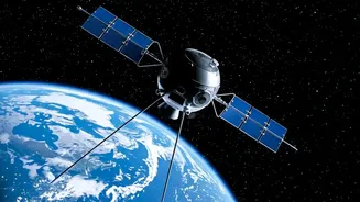
Imagine a camera that can see through clouds, dense fog, and even the dark of night. That is the power of Synthetic Aperture Radar (SAR), a sophisticated remote-sensing technique. Unlike traditional optical satellites that need light to capture images,
SAR sends its own microwave signals towards the Earth's surface and analyses the returning echoes. This active sensing allows it to create detailed, high-resolution images of the landscape, infrastructure, and environmental changes, regardless of weather conditions or time of day. This all-weather, day-and-night capability makes SAR an incredibly valuable tool for a country like India, which experiences diverse and dynamic climatic events like monsoons and cyclones.
Why This Skill Is a Game-Changer
Learning SAR is not just an academic exercise; it's a ticket to solving real-world problems. This technology is critical for disaster management, enabling authorities to map flood-inundated areas in near real-time, even under heavy cloud cover, and identify regions vulnerable to landslides. In agriculture, SAR data helps monitor crop health, soil moisture, and deforestation. It is also indispensable for urban planning, tracking land subsidence in cities, and for national security, where it is used for surveillance and reconnaissance. For a student, gaining expertise in SAR data analysis means acquiring a skill set that is in high demand across both government and private sectors.
Your Gateway: The IIRS Outreach Programme
The primary platform for this learning opportunity is the Indian Institute of Remote Sensing (IIRS), a constituent unit of ISRO located in Dehradun. Through its acclaimed Outreach Programme, IIRS offers a series of free online courses on remote sensing, GIS, and related technologies, including specific modules and workshops on SAR. These courses are delivered through a state-of-the-art e-learning platform and are designed to be accessible to a wide audience. The goal is to build capacity across the nation, empowering students and professionals with the skills needed to utilise space technology for national development.
Who Can Apply and How
These programmes are remarkably inclusive. Eligibility typically extends to undergraduate and postgraduate students from any year and any stream, as well as faculty members and government officials. The application process is straightforward and conducted online via the IIRS website. Prospective participants need to register on the portal. For some courses, registration happens through a nodal center, which can be the student's own college or university if it is networked with IIRS. After successful registration and approval, participants receive credentials to access the live interactive classes, study materials, and recorded lectures.
From Learning to a Career
Completing an IIRS course is more than just adding a line to a resume; it provides a recognised certificate from ISRO and a foundation for a promising career. Professionals with SAR and geospatial skills are sought after by a growing number of organisations. Government bodies like ISRO itself, the National Remote Sensing Centre (NRSC), and various environmental and disaster management agencies are major recruiters. Furthermore, India's burgeoning private space-tech and geospatial analytics sector, with companies like Pixxel and SatSure Analytics, actively seeks experts in SAR data analysis for roles in engineering, data science, and product development. These roles are not just jobs but opportunities to contribute to innovations in agriculture technology, climate monitoring, and infrastructure development.