




From Broad Strokes to Fine Details
For years, weather alerts from the India Meteorological Department (IMD) were broad, covering large regions or entire states. A forecast of "heavy rain" was useful, but it didn't pinpoint whether the deluge would hit your neighbourhood or a district 100
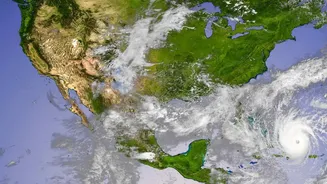
kilometres away. This has fundamentally changed. The IMD is now leveraging powerful supercomputers, advanced satellite imagery, and a dense network of automatic weather stations to provide district-level, and even city-level, forecasts. Known as impact-based forecasting (IBF), this new approach doesn't just predict the weather; it predicts what the weather will do. Instead of just a rainfall amount, the forecast now comes with specific warnings about potential waterlogging, traffic disruptions, or damage to infrastructure, often using a clear colour-coded system of green, yellow, orange, and red alerts.
Smarter Planning for City Streets
This granular data is a game-changer for municipal corporations, which are on the front lines of the monsoon battle. Armed with a reliable forecast predicting intense rainfall in specific zones, a city's disaster management cell can act preemptively. Imagine a scenario: an orange alert is issued for a particular zone in a city like Ahmedabad or Mumbai, predicting over 100 mm of rain in a six-hour window. Instead of waiting for roads to flood, the civic body can pre-deploy mobile water pumps to known waterlogging hotspots. Traffic police can be directed to set up diversions around low-lying underpasses before they become impassable. Public alerts can be sent to residents of that specific area, advising them to avoid certain routes or delay travel. This shifts the strategy from a city-wide reactive scramble to a targeted, proactive defence, saving time, reducing economic losses, and ensuring citizen safety.
Keeping India's Railways on Track
The value extends powerfully to Indian Railways, the nation's lifeline. The monsoon regularly wreaks havoc on the rail network, causing landslides in hilly sections and submerging tracks in low-lying areas, particularly in regions like the Northeast. In the past, railways often had to impose blanket speed restrictions or suspend services across entire divisions as a precaution. With route-specific and district-level warnings, the response can be much more precise. If the IMD warns of extremely heavy rainfall in a specific subdivision known for landslides, railway authorities can intensify track patrols in that exact section, position maintenance crews and materials nearby, and run trains at a reduced speed only on the vulnerable stretch. This targeted approach enhances safety without causing unnecessary, widespread disruption, keeping both passengers and essential goods moving more reliably.
The Challenge of Coordination
The technology, however, is only one part of the equation. The ultimate value of these advanced warnings hinges on a critical, and often challenging, component: inter-agency coordination. The IMD can provide a perfect forecast, but it's worthless if it isn't received, understood, and acted upon by the right people at the right time. This requires seamless communication channels between the meteorologists at IMD and the engineers in the municipal public works department, the officials in the railway control room, and the officers in the traffic police command centre. Building this institutional capacity to translate a weather forecast into a coordinated ground-level action plan is the next great challenge. In many Indian cities, the administrative structure is fragmented, with different departments working in silos.