






A Fortress of Nature Under Siege
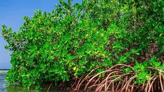
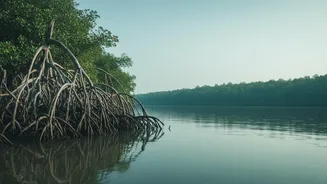
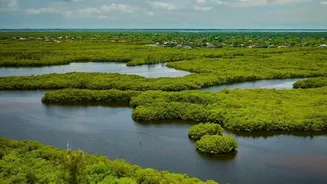
The Sundarbans is more than just a forest; it is a dynamic coastal buffer for millions of people, a critical carbon sink, and the iconic home of the Royal Bengal Tiger. This UNESCO World Heritage Site is a complex web of tidal waterways, mudflats, and resilient
mangrove species that protect inland communities from storm surges and erosion. However, this natural fortress is facing a barrage of threats that are deeply interconnected. Rising sea levels are increasing water and soil salinity, which harms less salt-tolerant mangrove species like the valuable Sundri tree. At the same time, reduced freshwater flow from upstream, pollution, and pressure from a dense human population are weakening the ecosystem's ability to recover. This combination of stressors makes the Sundarbans a fragile environment where small changes can have cascading negative effects.
The Challenge of On-The-Ground Monitoring
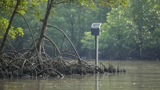
Imagine trying to conduct a health check-up on a patient who is nearly 10,000 square kilometres in size, with a landscape that is constantly shifting and largely inaccessible. This is the reality of monitoring the Sundarbans. Traditional methods involving on-foot surveys are slow, expensive, and often dangerous due to the challenging terrain and presence of wildlife. They can only cover tiny fractions of the forest, leaving vast areas unobserved for long periods. This makes it nearly impossible to get a comprehensive, real-time picture of the ecosystem's health, track the impact of cyclones, or identify the drivers of forest degradation across the entire delta.
Eyes in the Sky: A Technological Revolution
This is where satellite-based remote sensing becomes indispensable. From hundreds of kilometres above Earth, sensors on satellites from agencies like ISRO, NASA, and ESA act as impartial, tireless observers. These are not just simple cameras. They include optical sensors that capture images in different light spectrums and, crucially, Synthetic Aperture Radar (SAR) instruments. Unlike optical sensors, radar can 'see' through the dense cloud cover that frequently blankets coastal areas, and it can collect data day or night. By emitting their own energy waves and measuring the return signal, these sensors can gather detailed information about the forest's physical structure, such as canopy height and density.
From Raw Data to Actionable Insights
The data collected by these sensors allows scientists to track critical health indicators for the Sundarbans. By analysing sequences of images over time, they can map the precise extent of mangrove cover and pinpoint areas of deforestation or degradation. Specialised techniques and indices, like the Normalised Difference Vegetation Index (NDVI), measure the 'greenness' of the forest, revealing the health and vigour of the plants. A 'browning' trend detected in a specific area can be an early warning of stress from increased salinity or pollution. Following extreme weather events like cyclones, satellite imagery provides a rapid and safe way to assess the extent of damage across the entire forest, information that is vital for directing recovery efforts. This data also helps track long-term changes like coastal erosion and the shifting of river channels, which constantly reshape the delta.
Empowering Conservation and Policy
This wealth of information is not just for academic study; it is a powerful tool for conservation and governance. By identifying areas of declining health, authorities can target reforestation efforts more effectively. Understanding which parts of the mangrove forest offer the most protection against storm surges helps in planning coastal development and creating better early warning systems for vulnerable communities. The data provides clear, evidence-based insights that can inform transboundary management policies between India and Bangladesh, ensuring a unified approach to protecting the entire ecosystem. In essence, satellite monitoring transforms our understanding from fragmented snapshots into a continuous, comprehensive movie of the Sundarbans' life, enabling proactive management rather than reactive repair.