


The Crushing Heat
Residents of Delhi have been battling relentless heat, with maximum temperatures consistently hovering around 41 degrees Celsius, several notches above normal for this time of year. The situation has been made worse by high humidity, which has pushed
the heat index, or 'feels-like' temperature, to a punishing 48 to 51 degrees Celsius, making outdoor conditions extremely dangerous. The India Meteorological Department (IMD) even warned of heatwave conditions in parts of the city on June 28th, as minimum temperatures also remained uncomfortably high, offering little respite during the night.
When Is Relief Arriving?
The much-awaited relief is expected to begin from Monday, June 29th. The IMD forecast predicts a gradual but significant change, starting with partly cloudy skies and strong surface winds. The most noticeable shift is expected from Tuesday and Wednesday, for which a 'yellow alert' has been issued, signalling the likelihood of rain and thunderstorms. While isolated showers and gusty winds might provide fleeting relief over the weekend, the more sustained and impactful change is forecast for the coming week.
How Cool Will It Get?
The headline's promise to 'smash' the heat appears to be accurate. Forecasts indicate a significant temperature drop through the week. While the maximum temperature is expected to be around 39-41°C until Monday, it is predicted to fall to between 33°C and 35°C by the middle of the week. The most dramatic change is anticipated for Wednesday and Thursday, with some forecasts predicting maximums as low as 33°C. Minimum temperatures are also expected to see a gradual decline, providing more comfortable nights. This drop of 6-8 degrees will bring temperatures back towards the seasonal average.
What's Causing the Change?
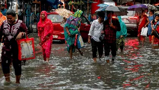
This welcome change is not a coincidence; it is driven by the broader weather patterns influencing northern India. The primary driver is the slow but steady advance of the Southwest Monsoon. Although the monsoon's arrival in Delhi has been delayed from its normal date of June 27, its progression into neighbouring states is finally creating favourable conditions for rainfall in the capital. The IMD notes that conditions are becoming favourable for the monsoon's further advance into the remaining parts of northwest India. These pre-monsoon showers and thunderstorms, fueled by moisture-laden winds, are the harbingers of the main event, effectively breaking the heatwave's grip.
Staying Safe During the Transition
While cooler weather is on its way, it is crucial to remain cautious. The final days of the heatwave can be particularly draining. Residents are advised to stay hydrated and avoid strenuous outdoor activity during peak afternoon hours. As the weather shifts, be prepared for thunderstorms and strong gusty winds, which could reach speeds of 40-50 kmph. These winds can cause disruptions, so securing loose objects on balconies and being mindful of traffic conditions is wise. The IMD has issued alerts for the coming days, so keeping an eye on the latest local forecasts will be essential for planning your week safely.