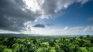







The Monsoon's Quiet Spell
As India entered the final month of the monsoon season, rainfall activity noticeably decreased, particularly over the southern peninsula. The India Meteorological Department (IMD) noted that while this was a lull and not a formal withdrawal, it led to
drier conditions in many areas. This quiet phase followed an uneven season overall, where some regions received surplus rain while others faced significant deficits. The slowdown raised questions about whether the 2026 monsoon was winding down for good, especially after the IMD's long-range forecast had initially suggested a below-normal season. However, weather patterns in the Bay of Bengal often hold the key to the monsoon's final act.
What is This 'Bay of Bengal System'?
The key player is a 'low-pressure area,' which is essentially a zone of lower atmospheric pressure. Think of it as a weather engine. These systems often begin as 'cyclonic circulations,' which are large, swirling patterns of wind. When these circulations become more organised and the pressure drops, they evolve into low-pressure areas. The Bay of Bengal is a prolific basin for these systems during the monsoon. According to the IMD's extended forecast, a fresh cyclonic circulation is expected to form over the central and northwest Bay of Bengal around September 11. This is the system that meteorologists believe holds the potential to restart widespread monsoon activity.
How It Recharges the Monsoon
A low-pressure system functions by drawing in air towards its center. Over a warm sea like the Bay of Bengal, this air is laden with moisture. The system's anti-clockwise rotation pulls these moisture-heavy winds from the sea and pushes them westwards over the Indian mainland. This influx of moisture strengthens the main engine of the season, known as the monsoon trough—an elongated low-pressure zone that extends from northwest India to the Bay of Bengal. As the Bay of Bengal system moves inland, it effectively drags this trough, activating rainfall across the regions it passes over. This process can trigger fairly widespread and often heavy rainfall, breaking the dry spell.
Which Regions Will See Rain?
The initial impact of this revival is expected in eastern and central India. The IMD has forecast that the developing low-pressure area will likely bring heavy rain to parts of West Bengal, particularly Gangetic West Bengal, until mid-September. States like Odisha, Jharkhand, and Chhattisgarh are also on the list to receive significant rainfall as the system moves inland. The influence is expected to extend further, with forecasts indicating that East Madhya Pradesh and parts of Uttar Pradesh could also see an increase in rainfall activity. However, the impact may be less pronounced in the southern peninsula and some parts of the northwest, which may continue to experience subdued rainfall for another week.
What This Means for the Rest of the Season
This Bay of Bengal system is crucial because September rainfall can play a deciding role in the season's overall performance. While one system may not erase the entire seasonal deficit for all regions, it can bring significant relief to farmers and help replenish water reservoirs. It breaks the prolonged dry phase and can pave the way for a more active end to the monsoon. The IMD has indicated that after a brief dry spell in some northern states, rainfall activity may revive there after September 12, potentially aligning with the westward movement of this new system. The event serves as a reminder that even in its final month, the monsoon can be highly dynamic and full of surprises.