


A Respite from Searing Heat
The past week has been a trial by fire for the people of East Uttar Pradesh. The region was caught in the grip of a severe heatwave, with temperatures consistently hovering well above normal. In cities like Prayagraj, the mercury soared to a blistering
43.4 degrees Celsius, making daily life a challenge. [20] The India Meteorological Department (IMD) had issued persistent heatwave warnings for the region, as maximum temperatures stayed in the punishing 40-43°C range. [19] This prolonged period of intense heat left millions eagerly awaiting a break in the weather, with the high humidity further amplifying the discomfort.
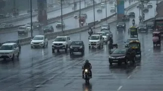
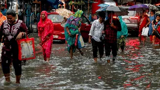
The Arrival of Cooling Showers
The much-awaited relief began to arrive as predicted by weather agencies. Over the weekend and into Monday, dark clouds gathered over large swathes of the region, unleashing thundershowers accompanied by gusty winds and lightning. [19, 20] The IMD had earlier issued alerts for as many as 28 districts, including major centres like Varanasi, Gorakhpur, Prayagraj, and Lucknow, anticipating this very weather event. [24] These showers, classified by the IMD as heavy in isolated places, brought an immediate and palpable change to the atmosphere, washing away the dust and cooling the super-heated ground.
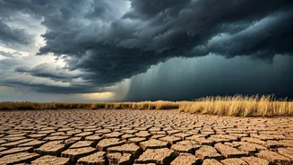
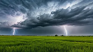
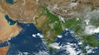
The Science Behind the Storms
So, what caused this sudden and welcome shift? This is not a random weather event but a classic case of pre-monsoon activity. Meteorologists point to a combination of factors creating the perfect storm for these showers. A seasonal trough—an elongated area of low pressure—is currently extending from Punjab to Bihar, creating atmospheric instability. [19] This trough is interacting with moisture-laden winds flowing in from the Bay of Bengal and the Arabian Sea. [9] When these moist air masses meet the hot, dry air lingering over the northern plains, they are forced to rise rapidly, leading to the formation of tall thunderclouds and the resulting downpours.
Is This the Monsoon's Official Arrival?
While the rain is a welcome sight, it's important to distinguish these showers from the official onset of the Southwest Monsoon for the entire area. These are pre-monsoon thunderstorms, a precursor to the main event. The monsoon's advance across the country has been somewhat delayed and weaker than usual for June, which contributed to the intense heat in the first place. [25] However, the good news is that the IMD has confirmed that conditions are now favourable for the Southwest Monsoon to advance further into Uttar Pradesh over the next two to three days. [9, 10] These initial showers are effectively paving the way for the main rainy season.
What the Forecast Holds
Residents can expect the wet and windy conditions to continue. Weather forecasts for cities like Gorakhpur, Varanasi, and Prayagraj show a high probability of scattered thunderstorms and rain persisting over the next several days. [5, 7, 8] The IMD has forecast fairly widespread to widespread rainfall across East Uttar Pradesh starting from June 30, with periods of heavy rain expected between June 30 and July 1. [19] This sustained wet spell is expected to cause a significant drop in maximum temperatures, bringing them down by 4-6°C and providing lasting relief from the heatwave conditions that have defined much of late June. [19]