





A Planet Under Pressure
Monitoring climate change has always been a monumental task. For decades, scientists have relied on a patchwork of satellites, ground stations, and models to track everything from rising sea levels to atmospheric carbon. While this has provided invaluable
data, the systems were often not designed to work together. The result is a fragmented picture, making it difficult to understand the complex, interconnected systems that govern our planet. As climate-related challenges like extreme weather, water shortages, and food insecurity intensify, the need for a more integrated and holistic view of Earth has become urgent.
The Earth System Observatory
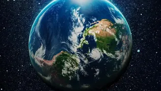
Enter NASA's Earth System Observatory. This is not just one satellite, but a fleet of advanced, next-generation missions designed to work in concert. The observatory will focus on five key areas: aerosols; clouds and precipitation; mass change in ice and water; surface biology and geology; and surface deformation. Each satellite is a specialist, but their data will be combined to create a comprehensive, 3D view of Earth, from the atmosphere to the bedrock. This initiative aims to provide critical data on climate change, natural hazards, and agricultural processes, addressing the most pressing questions about our planet.
India's Key Role in the Sky
A trailblazing mission for this new observatory is a partnership between NASA and the Indian Space Research Organisation (ISRO). The NISAR (NASA-ISRO Synthetic Aperture Radar) satellite will bring together two different radar systems to measure changes in Earth's surface with incredible precision—down to less than half an inch. This powerful tool will monitor some of the planet's most complex processes, such as the collapse of ice sheets, earthquakes, volcanoes, and landslides. For India, this provides an unprecedented ability to monitor groundwater depletion, track Himalayan glacier melt, and improve disaster management for floods and cyclones.
AI: The Brains of the Operation
Gathering terabytes of data is one thing; making sense of it is another. This is where artificial intelligence becomes crucial. NASA is partnering with tech leaders like IBM to develop powerful AI foundation models. These AI systems can sift through massive, complex datasets from the satellites at speeds no human could manage. The AI can identify patterns, fill in data gaps, and even predict events. For instance, AI is being trained to detect wildfires, delineate floodwaters, and classify land use for agriculture almost instantly. This turns raw satellite imagery into actionable intelligence.
From Data Points to Daily Decisions
The ultimate goal of this satellite-and-AI synergy is to deliver usable information that helps people on the ground. This initiative is being facilitated through NASA's Earth Information System, a collaborative platform designed to get data into the hands of decision-makers. For a farmer in Punjab, this could mean more accurate monsoon forecasts for planting crops. For officials in Mumbai, it could lead to better predictions of sea-level rise to protect coastal communities. The system can even help identify urban "heat islands" in cities like Delhi, informing public health strategies during heatwaves. By making complex Earth science open and accessible, NASA hopes to empower a new generation of solutions to global challenges.