





The Monsoon Gamble in Real Estate
Bengaluru's rapid urbanisation has come at a cost. The city once famous for its interconnected lakes has seen a 1,055% increase in built-up area, often at the expense of its natural drainage systems. Encroachment on historical lake beds and stormwater
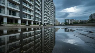
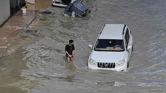
drains, or 'rajakaluves', has created a perfect storm for seasonal flooding. This isn't just an inconvenience; it's a significant financial and safety risk. Properties in areas like Bellandur, Sarjapur Road, Mahadevapura, and HSR Layout have seen repeated waterlogging, impacting access, causing property damage, and depressing resale values by as much as 15%. The question, "Does this area flood?" has shifted from a secondary concern to a primary factor in any property transaction.
A New Toolkit for Homebuyers
The good news is that homebuyers no longer have to make this multi-crore decision in the dark. A combination of official data and community-driven tech initiatives now allows for detailed flood risk assessment. The Bruhat Bengaluru Mahanagara Palike (BBMP) publishes a list of vulnerable storm water drain zones, identifying specific high-risk areas across the city. As of early 2026, this list included over 200 vulnerable points, with a high concentration in zones like Mahadevapura. Additionally, tech professionals and startups have developed free-to-use web tools. Platforms like 'Blr Water Log' use topographical data to create hydrological maps, showing the natural flow of water and identifying low-lying areas prone to accumulation. These tools, combined with official sources, provide a powerful starting point for any homebuyer.
How to Check Your Prospective Property
Assessing a property's flood risk is a multi-step process. Start by cross-referencing the property's survey number with official maps. The BBMP provides GIS maps showing lakes and stormwater drain buffer zones. There are strict no-construction rules within these buffers—typically 30-50 metres for rajakaluves and 75 metres for lakes—and violations can even lead to demolition orders. Next, use online tools to check the area's topography and historical flood data. Platforms that overlay survey numbers on flood index maps can quickly reveal if a plot is on a former lake bed or in a low-lying valley. Finally, consult the BBMP's list of flood-prone localities, which is often updated based on recent monsoon events.
Reading Between the Flood Lines
This data provides a risk profile, not a simple yes-or-no answer. A property near a vulnerable drain isn't automatically a write-off, but it demands deeper scrutiny. Consider the elevation of the specific building and basement in relation to the road. Ground floor units in identified flood-prone zones carry the highest risk of direct water entry. However, even an apartment on a higher floor is not immune to risk. Flooding often cuts off access roads, traps vehicles in basements, and disrupts essential services, affecting all residents of a building or community. Furthermore, banks are increasingly hesitant to finance properties in known high-risk zones, and securing home insurance can become more difficult and expensive.
Beyond the Data: On-Ground Verification
Data and maps are crucial, but they can't replace physical verification. Nothing beats visiting the property during or immediately after a heavy downpour to see how the local drainage holds up. Talk to people who already live in the neighbourhood or apartment complex. Ask direct questions about their monsoon experiences, waterlogging on access roads, and any history of water entering basements or ground-floor homes. Look for physical clues, such as water stains on compound walls or the elevation of neighbouring buildings. Combining this on-the-ground intelligence with the historical data provides the most comprehensive and reliable picture of the risks involved.