





Painting a Picture with Sound
The first step in underwater exploration is seeing what cannot be seen. Archaeologists can’t simply dive in and look around; the search areas are vast and visibility is often poor. Instead, they use sound. Survey ships equipped with advanced sonar systems
act as the initial scouts. Multibeam echosounders send out a fan-shaped pulse of sound waves that bounce off the seafloor and return to the vessel. By measuring the time it takes for these echoes to return, scientists can create detailed bathymetric maps, which are essentially 3D charts of the underwater terrain. Alongside this, side-scan sonar provides a different perspective, creating detailed, almost photographic images of the seabed's surface. These tools help researchers identify anomalies—unusual bumps or geometric shapes on the ocean floor that don't look natural and might indicate man-made structures.
Deploying the Digital Divers
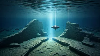
Once sonar mapping flags a potential site, the next phase is to get a closer, high-resolution look. This is where remotely operated vehicles (ROVs) come in. These unmanned submersibles, tethered to the ship, are the archaeologists' eyes in the deep. Outfitted with powerful lights and high-definition cameras, ROVs can navigate challenging underwater environments and get up close to potential structures without disturbing them. The primary goal at this stage is a technique called photogrammetry. The ROV, or sometimes a team of human divers, will systematically take hundreds or even thousands of overlapping photographs of the site from multiple angles. This immense collection of 2D images is then fed into specialized software. The software's algorithms identify common points across the photos and stitch them together to build a precise, photo-realistic 3D model of the ruin.
The Human Touch on the Seafloor
Technology provides the map, but human expertise is essential for interpretation and confirmation. Once a site is digitally reconstructed, teams of trained divers from institutions like the Archaeological Survey of India (ASI) or the Indian Maritime University descend for 'ground-truthing'. Their job is to physically verify the findings from the remote sensing data. They conduct visual inspections, take precise measurements, and carefully document artifacts and architectural features. In some cases, small-scale, targeted excavations may be performed. Unlike on land, this is a painstaking process where divers use specialized tools, often made of plastic to avoid saltwater corrosion, to gently remove sediment and uncover what lies beneath. Every artifact, from pottery sherds to stone anchors, is carefully cataloged in its original position before being considered for recovery. This context is crucial for understanding the site's history.
Connecting the Dots
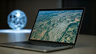
The final stage of mapping is a complex process of data integration. The sonar maps, the 3D photogrammetric models, the diver reports, and analysis of any recovered artifacts are all brought together. Using Geographic Information Systems (GIS), archaeologists layer this diverse information to create a single, comprehensive digital blueprint of the ancient site. This allows them to see not just individual structures, but the entire layout of a submerged settlement, including potential streets, buildings, and harbour complexes. In Tamil Nadu, these explorations off the coast of sites like Poompuhar (Kaveripoompattinam) and Korkai are not just academic exercises. They are attempts to scientifically verify accounts from ancient Sangam literature, which speak of great port cities swallowed by the sea.