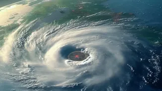







What is Cyclone Akvan?
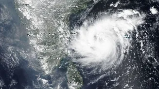
Cyclone Akvan is a tropical storm that formed over the Bay of Bengal and has been gathering strength. According to the IMD, the system intensified from a deep depression into a cyclonic storm on November 16 and has been moving towards the Indian coast.
As of November 18, it has strengthened into a Severe Cyclonic Storm. The name 'Akvan' was suggested by Iran as part of the regional naming convention for cyclones. These storms are a regular, though dangerous, feature of the post-monsoon season in the Bay of Bengal, which typically sees increased cyclonic activity between October and December.
The Projected Path and Timeline
The IMD is tracking the storm's path closely. Current projections show Cyclone Akvan moving northwestwards across the Bay of Bengal. It is expected to intensify into a 'Very Severe Cyclonic Storm' by the evening of November 19. The crucial period is the morning of November 20, when the cyclone is predicted to make landfall along the Andhra Pradesh and Yanam coasts. The expected crossing point is a stretch of coastline between Nellore and Visakhapatnam, with the landfall anticipated around noon.
Expected Intensity and Impact
At landfall, Cyclone Akvan is forecast to be a 'Very Severe Cyclonic Storm' with maximum sustained wind speeds of 120-130 kmph, and gusts reaching up to 145 kmph. Winds of this speed can cause significant damage to infrastructure, including uprooting trees and power poles, and damaging homes, particularly temporary structures. The IMD has also warned of extremely heavy rainfall in the coastal districts of Andhra Pradesh on November 19 and 20. This could lead to widespread waterlogging and localised flooding. A storm surge of up to two metres is also possible, which could inundate low-lying coastal areas. Neighbouring states like Tamil Nadu, Telangana, and Odisha are also expected to receive heavy rainfall.
Official Warnings and Preparations
Authorities are on high alert. The IMD has issued an 'Orange Message' cyclone alert for the Andhra Pradesh coast. Fishermen have been strictly advised not to venture into the west-central and northwest Bay of Bengal until after November 20, and those at sea have been ordered to return to shore immediately. The Andhra Pradesh government, led by the Chief Minister, has directed officials in coastal districts to take all precautionary measures. Disaster response teams, including the National Disaster Response Force (NDRF), have been deployed to vulnerable areas, and preparations for potential evacuations are underway. The South Coast Railway is also taking measures to ensure passenger safety and protect railway assets.
How to Stay Safe
For residents in the potentially affected areas, preparation is key. It is crucial to monitor official announcements from the IMD and local disaster management authorities, and not rely on rumours. Secure your home by boarding up windows and clearing your yard of any loose objects that could become projectiles in high winds. Prepare an emergency kit with essentials like non-perishable food, drinking water, batteries, a torch, a first-aid kit, and any necessary medications. Keep your mobile phones fully charged. If you are in a low-lying area or your home is not structurally sound, be prepared to move to a designated public shelter if advised by authorities. Stay indoors during the cyclone and away from windows. Do not go outside until officials declare it is safe to do so.