






The Unseen Risk Beneath the Surface
For residents of India's Silicon Valley, the sight of flooded roads and submerged basements has become an unwelcome seasonal fixture. The city's rapid, often unplanned, urbanisation has come at a cost. Studies, including a recent analysis highlighted
by civic authorities, consistently point to a core issue: the encroachment and concretization over the city's natural drainage systems. Bengaluru was built around a series of interconnected lakes and valleys, a natural flood mitigation system. Today, with many lakes vanished and over 65% of stormwater drains (SWDs) blocked or encroached upon, heavy rains have nowhere to go. This reality is now a primary concern for property investors, with inquiries dropping in flood-prone areas and buyers becoming more discerning.
Your New Essential Tool: The Drain Map
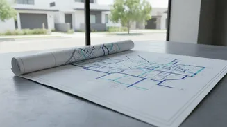
The 'rajakaluve' or SWD map is emerging as the single most important document in a homebuyer's toolkit. For years, information on these drains was hard to access, often buried in complex survey drawings. However, initiatives by the Bruhat Bengaluru Mahanagara Palike (BBMP) and research institutions have made these maps more accessible. These maps, available on government portals, show the network of primary, secondary, and tertiary drains across the city. By cross-referencing a property's survey number with these maps, a buyer can identify if the land is on or near a drain, a critical first step in assessing flood risk. One portal, rajakaluve.org, was launched by IIMB-RERI with BBMP support to help citizens check if their property sits on an SWD.
Why Maps Are Just the Beginning
While checking the official map is crucial, it's not the final word. The bigger challenge lies in illegal encroachments and unmapped obstructions. A property may not sit directly on a marked drain, but it could be in a designated 'buffer zone'—a no-construction area around a drain where building is illegal. Banks are increasingly hesitant to fund properties in such zones, and they carry a significant risk of future demolition orders from the BBMP or courts. Therefore, due diligence must extend beyond the map. Look for physical signs: Is the property in a low-lying area? Are there signs of dampness or water marks on nearby compound walls? Does the seller or builder get defensive when asked about drainage? These are all red flags.
A Homebuyer's Flood-Proofing Checklist
In the current market, caution is the best investment. Your pre-purchase checklist must now be more rigorous than ever.
1. Verify Official Maps: Use the BBMP's GIS portal and other official drain maps to check the property’s survey number against the rajakaluve network.
2. Inspect Historical Land Use: Use tools like Google Earth and Survey of India toposheets to see what the land was used for historically. Was it a lakebed, a marsh, or a valley?
3. Physical Site Visit (During Rains): If possible, visit the area during or after a heavy downpour to observe waterlogging firsthand.
4. Check Buffer Zone Compliance: Understand the specific buffer zone rules for the drain's classification (primary, secondary, etc.) and ensure the property is compliant. A licensed surveyor can provide an accurate report.
5. Legal Scrutiny: A property lawyer should conduct a thorough check of the land's history, verifying all approvals and ensuring there are no encroachment notices or pending litigation.
6. Talk to Neighbours: Local residents are often the best source of information about an area's flooding history.