
What Happened in Nepal?
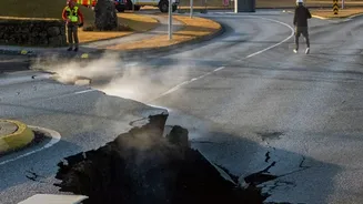
On August 26, 2026, a catastrophic flash flood tore through central Nepal. Scientists believe the disaster was triggered by a massive ice and rock avalanche from a glacier near the Nepal-Tibet border. This collapse sent a powerful surge of water, mud,
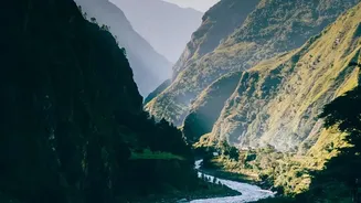
and debris down the Bhote Koshi and Trishuli river systems, causing immense destruction in the Rasuwa, Nuwakot, and Dhading districts. The event was so powerful it registered as a magnitude 5.2 seismic event. The floods destroyed entire settlements, swept away dozens of bridges, and obliterated critical road infrastructure, including the main route connecting Kathmandu to the Rasuwagadhi border crossing with Tibet. The death toll has tragically climbed into the hundreds, with many more, including foreign nationals, reported missing.
Which Areas Are Directly Affected?
The disaster is concentrated in a specific corridor along the Bhote Koshi and Trishuli rivers. The Rasuwa district, particularly settlements like Timure and Syabrubesi, bore the brunt of the initial impact. Syabrubesi is a key gateway for trekkers heading into the Langtang Valley, a popular trekking destination. The destruction of the Rasuwagadhi border post means the overland route for pilgrims and tourists heading to Mount Kailash in Tibet is closed for the foreseeable future. Authorities have warned people to remain on high alert along the riverbanks in Nuwakot, Dhading, Gorkha, and even as far downstream as Chitwan. Rescue and recovery operations are intensely focused on this corridor, which remains largely inaccessible by road.
Are Major Trekking Regions Safe?
Crucially, most of Nepal's premier trekking regions were not in the flood's path and remain unaffected. The Trekking Agencies' Association of Nepal (TAAN) and other tourism bodies have confirmed that the Everest (Khumbu) and Annapurna regions are safe and fully operational. Flights to Lukla, the starting point for Everest treks, are running normally. Similarly, the Annapurna Circuit, Annapurna Base Camp, and Poon Hill trails are open. While the Manaslu region is considered safe, the standard approach road was damaged, requiring trekkers to use an alternative route to reach the trailhead. The primary closure is the Langtang Valley trek due to the severe damage in its gateway town, Syabrubesi, and the connecting highways.
Official Advice for Travellers
The consensus from tourism authorities is that while the disaster is severe, it is geographically contained. The Nepal Tourism Board has established a special information desk to provide updates on missing and rescued tourists. While they have stated Nepal is open for international travellers, the situation in the affected districts is grave. Foreign governments, including the UK and US, are urging their citizens to follow the advice of local authorities, monitor the news, and be aware that the situation can change rapidly, with risks of further flooding. Travellers are strongly advised not to journey to the Rasuwa district and the Bhote Koshi corridor. For those with trips booked to unaffected areas, the general advice is to proceed with caution.
Your Safety Checklist Before You Go
With the peak season just weeks away, careful planning is more critical than ever. First, contact your airline and tour operator immediately to confirm your specific itinerary and get an on-the-ground assessment. Do not rely on outdated information. Ensure you have comprehensive travel insurance that explicitly covers medical evacuation, as emergency services and medical facilities in Nepal are limited, especially outside Kathmandu. Before you depart, register your travel plans with your respective embassy. Upon arrival, follow all instructions from local authorities and your guide. Given the damage to infrastructure, be prepared for potential travel disruptions and have contingency plans. Continuously monitor weather forecasts and local news alerts, as the monsoon season officially lasts through September, and conditions can shift.