


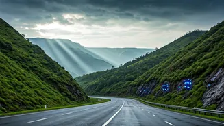


The Monsoon's Treacherous Grip
The Western Ghats, a UNESCO World Heritage site, are as beautiful as they are dangerous. During the monsoon months, these majestic mountains become a hotspot for landslides. Heavy rainfall saturates the soil on steep slopes, creating a volatile mix of
mud, rock, and debris that can come crashing down onto highways with little to no warning. For decades, the communities and commuters in states like Kerala, Karnataka, and Maharashtra have lived with this seasonal peril. Major roads, which are economic lifelines, can be severed for days or weeks, and the human cost is often tragic. Traditional methods of prediction, relying on weather forecasts and historical data, have proven insufficient to provide the timely, location-specific warnings needed to save lives.
A Digital Sentinel on the Slopes
In response to this challenge, Indian scientists and engineers have developed a groundbreaking solution: a real-time landslide warning system. Pioneered by researchers at Amrita Vishwa Vidyapeetham in Kerala, this system acts as a digital sentinel, constantly monitoring the mountainside for the tell-tale signs of an impending collapse. Unlike broad weather alerts, this technology is designed to detect minute, localised changes in the ground itself. It's a shift from forecasting a possibility to detecting an imminent reality. The goal is to provide a precious window of time—from several hours to even a full day—for authorities to evacuate residents, halt traffic, and prevent disaster before it strikes.
How the System Predicts Disaster
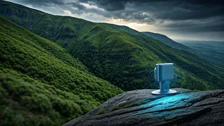
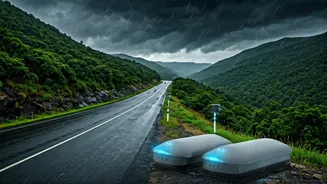
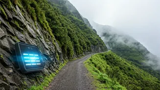
The technology works by embedding a network of wireless sensors deep within landslide-prone slopes. These aren't just simple weather vanes; they are a suite of high-tech instruments measuring multiple parameters. Geotechnical sensors track subtle ground movements and vibrations. Pore pressure sensors measure the amount of water pressure building up within the soil—a critical indicator of instability. Other sensors record rainfall intensity, soil moisture, and temperature. This data is collected every few minutes and transmitted wirelessly to a central server. This creates a live, dynamic picture of the hillside’s stability, far more detailed than any satellite image or weather report could provide. The sheer volume and variety of data collected form the backbone of the system’s predictive power.
From Data Points to Public Alerts
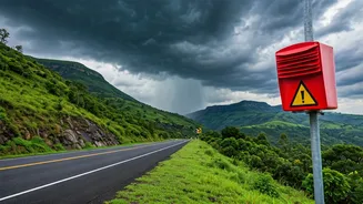
Collecting data is only half the battle. The real innovation lies in how it's interpreted. The system uses artificial intelligence and machine learning algorithms to analyse the incoming flood of information. These models are trained on years of data from past landslide events, allowing them to recognise the specific combination of factors that precedes a slope failure. When the system detects a high-risk pattern, it automatically triggers an alert. These warnings are not sent directly to every driver’s phone. Instead, they are relayed to district-level government officials, disaster management authorities, and local police. These authorities are then responsible for disseminating the warning to the public through sirens, community announcements, and by physically stopping traffic on threatened routes. So while drivers themselves may not be interacting with the system, they rely on the protective cordon it enables authorities to create.
A Lifeline in Munnar and Beyond
The system has already proven its worth in some of the most vulnerable regions. In Munnar, a popular hill station in Kerala that is notoriously prone to landslides, the deployment has been a game-changer. Authorities have received advance warnings that have enabled them to manage traffic and secure areas, potentially averting major accidents. Following its success in the Western Ghats, the technology has also been installed in the Himalayas in Sikkim, another region plagued by landslides. These pilot projects demonstrate a scalable and effective model for public safety in India's mountainous terrains. While not yet deployed across the entirety of the Ghats, these installations represent a critical first step towards a future where technology can stand guard over the nation's most treacherous roads.