







A City Built on Unstable Ground
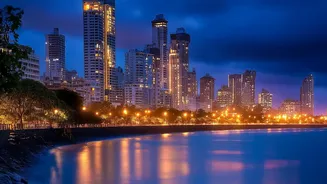
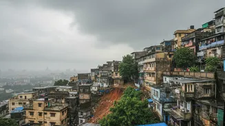
Mumbai’s fundamental challenge lies in its geography. The city is an archipelago, a dense urban sprawl built across what were once islands, with significant portions of land reclaimed from the sea. More importantly, the landscape is dotted with numerous
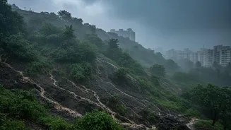
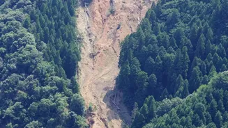
hills and slopes. Much of this terrain consists of fractured rock and loose soil, which becomes dangerously unstable when saturated with water. A 2018 report by the Geological Survey of India (GSI) highlighted that many of these slopes are naturally steep and composed of jointed rock, creating inherent weaknesses. This geological makeup provides the perfect foundation for landslides; all that's needed is a powerful trigger.
The Science of a Saturated Slope
The trigger, invariably, is the intense and prolonged rainfall of the monsoon. When torrential rain pounds a hillside for days, the water seeps deep into the soil and rock fractures. This process does two things: first, it dramatically increases the overall weight of the slope. Second, and more critically, it increases what engineers call 'pore water pressure'. This is the pressure of water filling the spaces between soil and rock particles, which effectively pushes them apart and drastically reduces the friction and natural cohesion that holds the slope together. A slope that seemed stable can suddenly give way when it reaches this critical saturation point, resulting in a sudden, catastrophic flow of mud, rocks, and debris.
The Human Factor: Unchecked Development
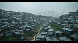
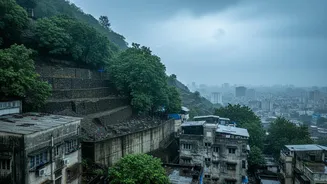
Natural geology and heavy rain are only part of the story. Experts point to human activity as a massive aggravating factor. Decades of rapid, often unplanned, urbanisation have seen construction creep up the city’s hillsides. To create flat ground for housing, slopes are often cut into, removing the natural support at the base of the hill. This practice, known as 'toe cutting', makes the entire slope above much more susceptible to failure. Furthermore, deforestation and the removal of vegetation strip the hills of the root systems that help bind the soil. The construction of informal settlements, or slums, on and below these slopes also blocks natural drainage channels, forcing water to pool and seep into the ground, accelerating soil saturation.
Mumbai's Most Vulnerable Pockets
Authorities have identified hundreds of landslide-prone locations across the city. According to data from the Brihanmumbai Municipal Corporation (BMC), over 250 such spots exist, with more than one lakh people living in these high-risk zones. The GSI has classified 74 of these as highly vulnerable. Areas like Ghatkopar, Vikhroli, Kurla, Bhandup, and Chembur are frequently cited as primary risk zones. The Vikhroli-Bhandup belt has the highest concentration, with over 150 identified sites. These are often densely populated areas where informal settlements are packed against the base or edge of steep, unstable hills, magnifying the potential for tragedy when a landslide occurs.
A Cycle of Warnings and Reluctance
The problem is not a lack of awareness. Every year before the monsoon, the BMC issues notices to residents in these dangerous areas, urging them to evacuate to temporary shelters. However, these efforts meet with limited success. Residents are often reluctant to leave their homes, citing proximity to jobs and their children's schools as reasons for staying. For many, the risk of a landslide is weighed against the immediate disruption of relocation and the lack of viable, safe, and affordable long-term housing alternatives. While authorities have built retaining walls and other mitigation measures in some areas, many projects remain incomplete, and experts argue these structural fixes are not enough without addressing the root causes of encroachment and unsustainable development.