



Meet Prithvi: A New Brain for Earth Science
The innovation at the heart of this revolution is a powerful new artificial intelligence called Prithvi, a name derived from the Sanskrit word for Earth. Developed through a landmark collaboration between NASA and IBM, Prithvi is a 'foundation model'.
Think of it like the highly trained engine in large language models that understand human text. Instead of words, Prithvi has been trained on a colossal amount of unlabeled satellite imagery—specifically, years of data from the Harmonized Landsat and Sentinel-2 (HLS) global dataset. This process allows the AI to learn the intricate patterns of Earth's surface on its own, detecting nuances that might escape human observers. Because it's open source, researchers and scientists anywhere in the world can access and adapt it, accelerating scientific progress for everyone.
From Data Overload to Actionable Insight
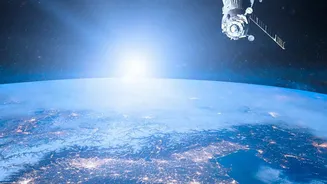
For decades, the biggest challenge in Earth observation wasn't collecting data, but analysing it. By 2024, NASA estimated it would hold 250,000 terabytes of data from its missions, a figure that is constantly growing. Traditionally, analysing this imagery required specialised, time-consuming human effort or highly specific, inflexible algorithms. Foundation models like Prithvi change the game entirely. Once the massive initial training is done, the model can be quickly 'fine-tuned' for a wide variety of specific tasks with much smaller amounts of labeled data. This slashes development time and cost, making sophisticated analysis more accessible. In a significant recent milestone, a version of Prithvi became the first geospatial AI foundation model ever deployed in orbit, running on platforms aboard the International Space Station and another satellite to perform real-time analysis.
Real-World Impact: From Floods to Farms
The potential applications for this technology are vast and transformative. Prithvi has already shown remarkable capability in mapping environmental events with greater speed and accuracy. For disaster management, it can rapidly delineate the extent of flooding or map burn scars left by wildfires, providing crucial information for first responders. In agriculture, the AI can be used to monitor the health of crops and predict yields, a vital tool for ensuring food security in a changing climate. The model is adaptable enough that researchers have even used it for unexpected applications, like successfully predicting locust breeding grounds in Africa—a problem they had struggled to solve for years until Prithvi was released. Its ability to generalise from one task to another is what makes it so powerful; a model fine-tuned to map coastal habitats in one part of the world can be successfully applied to another with limited local data.
Why This Is a Revolution in Observation
The 'revolution' lies in the shift from slow, reactive analysis to fast, predictive insight. By deploying AI directly on satellites, analysis can happen on the edge, before the data even touches the ground. This reduces bottlenecks and allows for near-real-time intelligence. Furthermore, the technology enables satellites to become smarter. In a related concept called Dynamic Targeting, NASA is testing AI that allows a satellite to decide for itself what to photograph, avoiding cloudy areas and focusing on scientifically valuable targets without human command. Looking ahead, future versions could even allow scientists to interact with satellites using natural language, asking questions about the data it's seeing in a conversational way. This democratises access to complex satellite data, moving it beyond the exclusive domain of highly funded institutions and into the hands of a broader global scientific community.