




The View from Above
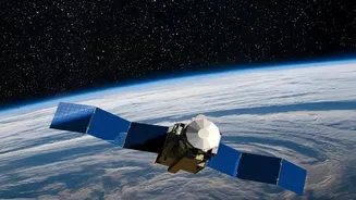
High above the earth, the Indian Space Research Organisation's (ISRO) fleet of ocean-observing satellites is constantly at work. The latest in this series, EOS-06, also known as Oceansat-3, circles the globe, providing a wealth of data about our planet's
seas. Launched in November 2022, this advanced satellite is the culmination of decades of expertise, building on the legacy of earlier Oceansat missions that began in 1999. Equipped with sophisticated sensors like the Ocean Colour Monitor (OCM-3) and a Sea Surface Temperature Monitor, its primary job is not to spot individual fish, but to read the very language of the ocean itself. This stream of information is the crucial first step in a technological chain that ends with a fisherman getting a timely alert on his phone.
Painting the Sea By The Numbers
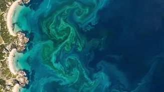
The key to this entire operation lies in a concept called 'ocean colour'. This doesn't refer to the brilliant blues we see in travel photos, but the subtle, almost invisible shifts in shade caused by microscopic life. The most important of these is phytoplankton, tiny plant-like organisms that form the base of the marine food web. They contain chlorophyll, the same pigment that makes plants on land green. ISRO's Ocean Colour Monitor is designed to be incredibly sensitive to these slight variations in colour. It measures how sunlight scatters off the sea's surface, allowing scientists to map the concentration of chlorophyll across vast stretches of water. In essence, the satellite creates a detailed, daily map showing where these massive phytoplankton blooms are located.
Where There’s Colour, There’s Food
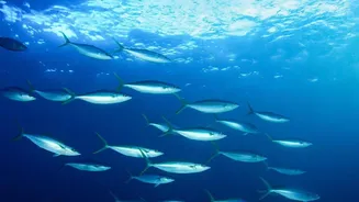
The connection between chlorophyll and fish is a simple, yet powerful one based on the food chain. Phytoplankton are the primary food source for zooplankton, which in turn are eaten by small fish like sardines and mackerel. These small fish then attract larger, commercially valuable species that fishermen seek. The satellite, by mapping chlorophyll, isn't finding the fish directly; it's finding their restaurant. Areas with high concentrations of phytoplankton, combined with specific sea surface temperatures, create conditions ripe for a fish feeding frenzy. These spots are identified by scientists as Potential Fishing Zones (PFZs). The satellite data helps pinpoint features like ocean fronts, eddies, and upwellings where these nutrient-rich waters congregate, making them prime locations for fish aggregation.
From Data to a Fisherman's Phone
Raw satellite data is complex. To make it useful for a fisherman in his boat, it needs to be translated. This is the critical work of the Indian National Centre for Ocean Information Services (INCOIS). Scientists at INCOIS process the data from ISRO's satellites daily, combining ocean colour information with sea surface temperature readings. They use this to generate the PFZ advisories. These are not just vague suggestions but highly specific maps containing latitude and longitude coordinates, the expected depth of the fish, and the distance and direction from prominent coastal landmarks. This vital information is then disseminated to coastal communities through a multi-channel system that includes mobile apps, SMS alerts, websites, and broadcasts on radio and television, often in local languages to ensure maximum accessibility.
The Real-World Impact
The benefits of this service are transformative for India's fishing community. By knowing where to go, fishermen can significantly reduce the time and fuel spent searching for fish, which often represents a major portion of their operational costs. Studies have shown that using PFZ advisories can cut search times by 30 to 70 percent. This increased efficiency leads to better catches, higher incomes, and improved safety, as fishermen spend less time on the open sea exposed to unpredictable weather. Furthermore, the system enhances safety. Devices like GEMINI, which use satellite navigation, can relay not only PFZ information but also crucial alerts about cyclones and high waves to fishermen who are far from the coast, beyond the reach of normal mobile networks. This application of space technology provides a direct boost to the livelihood of nearly nine lakh fishermen and the entire blue economy.