


The Anatomy of a Flood
To understand why young Bengalureans are turning into amateur hydrologists, one must first understand the city's chronic flooding. For years, experts have pointed to the root causes: rapid, unplanned urbanization, the encroachment of lake beds and wetlands,
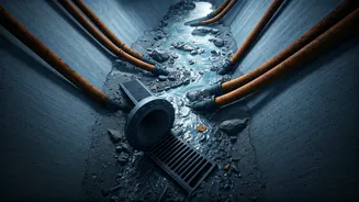
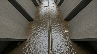
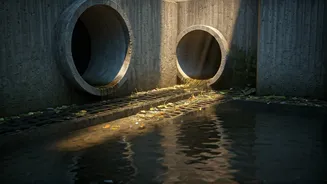
and the choking of the city’s vital network of storm-water drains, known as *rajakaluves*. These drains, designed to carry excess rainwater away, are often blocked by illegally dumped construction debris, solid waste, and silt. When heavy rains arrive, the overwhelmed system backs up, turning arterial roads into rivers and inundating low-lying residential areas. The consequences range from crippling traffic jams and property damage to serious public health risks.
From Keyboard Warriors to Ground Warriors
For a generation fluent in digital tools and social media, complaining online about civic apathy is second nature. However, a growing number of young citizens are moving beyond digital outrage to organised, on-ground action. They recognise that while municipal bodies like the Bruhat Bengaluru Mahanagara Palike (BBMP) are officially responsible, the scale of the problem requires a more granular, citizen-driven approach. This shift marks a significant change in civic engagement. Instead of simply waiting for the authorities to act, they are proactively collecting the very data that can guide and pressure those authorities into taking targeted action.
Tech for the Trenches: How It Works
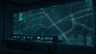
The process is a blend of simple observation and modern technology. Armed with smartphones, groups of volunteers walk or cycle through their neighbourhoods, particularly before the monsoon season. They use GPS-enabled applications and camera phones to document every choke point they find. An overflowing garbage bin blocking a drain entrance, a pile of construction rubble narrowing a channel, a stretch of a drain completely covered by an illegal slab—each is photographed, geo-tagged, and logged. This information is then compiled onto open-source platforms like Google Maps or specialised mapping software, creating a live, visual database of the neighbourhood's drainage health. Some groups use social media, tagging local officials and media outlets to draw immediate attention to critical blockages.
The Power of Hyperlocal Data
This citizen-generated data is powerful precisely because it is hyperlocal. While official surveys may provide a broad overview, they often miss the small, localised blockages that collectively cause widespread flooding. This detailed mapping allows for a more surgical approach to prevention. Residents' Welfare Associations (RWAs) can use the maps to organise local clean-up drives or to present a concrete, evidence-based case to their local corporator or BBMP official. By making the data public, these groups create a tool for accountability. It becomes much harder for officials to claim ignorance when a map, complete with photographic evidence and exact locations, is circulating online and within the community.
Building a Culture of Resilience
Ultimately, this movement is about more than just clearing drains. It represents a fundamental reimagining of the citizen's role in urban governance. By taking ownership of their immediate environment, these young people are fostering a culture of preventative action and shared responsibility. They are demonstrating that a city’s resilience is not solely the government's job but a collaborative effort. This proactive stance sends a clear message: citizens are not just passive victims of urban decay but active participants in building a more functional and flood-proof city. The hope is that these efforts not only lead to cleaner drains but also inspire a wider movement of civic participation across other urban challenges.