


Seeing the World in Different Light
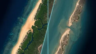
Think of satellite sensors like different types of cameras. Your phone has a camera that sees the world much like the human eye. This is similar to an optical satellite sensor, which captures reflected sunlight. These images are intuitive and photo-like,
excellent for identifying land cover, monitoring urban growth, and assessing crop types in clear conditions. However, their major weakness is that they are dependent on daylight and can't see through clouds, smoke, or haze. This is a significant problem in tropical regions or areas prone to wildfires, where persistent cloud cover or smoke can hide what's happening on the ground for weeks at a time.
Piercing Through Clouds and Darkness
This is where another type of sensor, Synthetic Aperture Radar (SAR), becomes invaluable. Unlike optical sensors that passively record sunlight, SAR is an active sensor. It sends out its own microwave pulses and measures the signal that bounces back. Because it creates its own 'light', it can operate day or night. Crucially, these microwaves can penetrate clouds, dust, and smoke, providing an uninterrupted view of the Earth's surface regardless of weather or time of day. While SAR images are less intuitive to the human eye—appearing as grainy, monochrome images that show texture and structure rather than colour—they provide critical information about surface roughness, moisture content, and elevation.
The Dimensions of Resolution
Beyond the basic type, sensors also differ in four key types of resolution. Spatial resolution refers to the level of detail, or the size of a single pixel on the ground—is it 30 metres or 30 centimetres? Temporal resolution is about frequency—how often a satellite revisits the same spot. It could be daily, or it could be every 16 days. Spectral resolution defines how many different bands of the electromagnetic spectrum the sensor can 'see', including wavelengths invisible to the human eye like near-infrared, which is vital for assessing plant health. Finally, radiometric resolution measures how sensitive the sensor is to variations in brightness. There's a constant trade-off; a satellite with very high spatial detail might have a lower temporal frequency.
A More Complete Picture Through Fusion
Combining data from different sensors, a process known as data fusion, allows scientists to overcome the limitations of any single instrument and create a far more accurate and comprehensive understanding. For example, to monitor deforestation in the Amazon, a researcher might use an optical satellite to identify different types of forest when the skies are clear. They would then use SAR data to continue monitoring during the cloudy rainy season, detecting illegal logging that would otherwise go unseen. In disaster response, optical imagery can assess flood damage in visible areas, while SAR can map the full extent of the floodwaters under cloud cover. This integration of multiple data sources enhances accuracy, reduces uncertainty, and provides insights that wouldn't be possible with individual datasets alone.