







India's Sentinels in Space
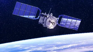
India, through the Indian Space Research Organisation (ISRO), operates a sophisticated fleet of Earth Observation (EO) satellites. These satellites, like those in the Cartosat and Resourcesat series, are equipped with advanced sensors that provide a comprehensive
and synoptic view of the Earth's surface at regular intervals. This capability is the cornerstone of modern disaster management. ISRO's Disaster Management Support Programme uses this space-based information to assist various government bodies, including the National Disaster Management Authority (NDMA), in handling natural calamities. The data is processed and disseminated through platforms like the Bhuvan geo-portal, turning raw images into actionable intelligence for authorities on the ground.
Seeing Through Clouds and Darkness
One of the biggest challenges in monitoring floods, especially during the monsoon, is persistent cloud cover, which blinds traditional optical satellites. This is where Synthetic Aperture Radar (SAR) technology becomes a game-changer. SAR is a type of remote sensing that can penetrate clouds, haze, and rain, and it works both day and night. It does this by actively sending out a signal and reading the echo that bounces back. Water surfaces are smooth and reflect the signal away from the satellite, appearing as dark patches in the imagery. This makes it incredibly effective for accurately mapping the extent of floodwater even in the worst weather conditions. ISRO's RISAT (Radar Imaging Satellite) series is specifically designed for this purpose, providing crucial all-weather surveillance.
Before the Deluge: Improving Early Warnings
The most effective way to save lives is to provide timely and accurate warnings. Satellite data is a critical input for hydrological models that forecast river flows and potential inundation. By observing factors like snowmelt, soil moisture, and rainfall intensity over large, often inaccessible areas, these models can predict when and where a river is likely to breach its banks. Agencies like the Central Water Commission and IMD, integrated under the NDMA's alert system, use this information to issue targeted alerts. This advanced notice gives authorities crucial time to pre-position resources, alert vulnerable populations, and begin evacuations before the disaster strikes, significantly reducing potential casualties.
During the Crisis: Guiding Rescue Operations
Once a flood occurs, chaos can ensue. Roads become impassable, communication lines may fail, and the true extent of the disaster is often unknown. Near real-time satellite imagery provides the first clear picture of the situation. Rescue agencies can see precisely which villages are submerged, which roads are cut off, and where people might be stranded. This allows for the efficient allocation of rescue teams, boats, and helicopters to the areas most in need. For example, during major floods in states like Kerala and Assam, ISRO has programmed its satellites to capture frequent images of the affected areas, generating inundation maps that are shared with state and central agencies to guide relief operations.
After the Flood: Assessing the Damage
The work doesn't end when the water recedes. Recovery requires a detailed understanding of the damage to homes, infrastructure, and agriculture. High-resolution satellite images taken before and after the flood are compared to conduct rapid and accurate damage assessments. This information is vital for government agencies to plan relief efforts, allocate financial aid, and prioritize reconstruction projects. It helps in verifying insurance claims and creating a comprehensive record of the event's impact. ISRO has created a Flood Affected Area Atlas for India, using over two decades of satellite data to map and document the history of flooding across the country, which aids in long-term planning and mitigation.
A Global Collaboration
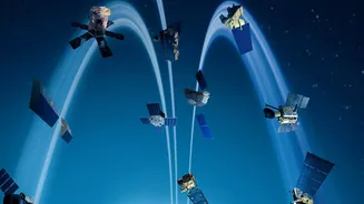
India also benefits from and contributes to international cooperation. As a founder member of the International Charter 'Space and Major Disasters', ISRO can request and receive satellite data from 17 member space agencies during large-scale disasters. This collaborative framework ensures that a wide array of satellite assets can be tasked to cover a disaster, providing more frequent and diverse data than any single country could achieve alone. This global partnership enhances India's own formidable capabilities, ensuring the best possible space-based support is available during a crisis.