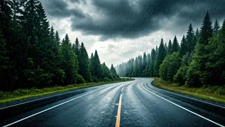


The Predictable Monsoon Mayhem
Every year, as the monsoon arrives, it brings both relief and chaos. For commuters in major Indian cities, heavy rainfall means one thing: waterlogging. Key roads and underpasses become impassable, public transport is disrupted, and traffic grinds to
a standstill for hours. Traditional weather forecasts can tell you it's going to rain, but they can't tell you if your specific route home is currently submerged under a foot of water. This lack of real-time, hyperlocal information is what turns a predictable downpour into an unpredictable and frustrating ordeal for millions.
Your Phone's Hidden Superpower
The solution lies not in complex meteorological equipment, but in the collective power of the community. The same smartphone you use to check emails and scroll through social media can become a powerful tool for navigating flooded cityscapes. This is made possible through crowd-sourcing, a simple but brilliant concept: what if everyone stuck in traffic could share real-time information about road conditions with each other? This collective intelligence, gathered and displayed on a digital map, creates a live, dynamic picture of the city's streets, allowing you to see problems as they happen and, more importantly, how to avoid them.
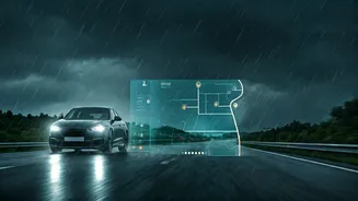
How It Works: People-Powered Data
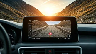
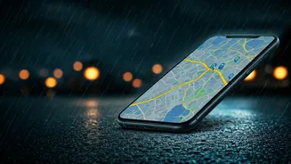
Crowd-sourced navigation apps like Google Maps and Waze rely on two main data streams. The first is passive: by simply having the app open while you drive, you are anonymously sharing your location and speed. When thousands of phones in one area slow down to a crawl, the app's algorithm marks that stretch of road as having heavy traffic. The second stream is active, and this is where the magic happens for flooding. Users can actively report hazards they encounter on the road. With just a few taps, you can mark a location for 'Water on road', 'Flooding', or 'Pothole'. When multiple users report the same issue in the same area, the app validates the report and displays a warning icon on the map for all other users to see.
The Right Tools for the Job
You probably already have the necessary tools installed. Google Maps is the most ubiquitous. Its real-time traffic data is excellent, and the option to report hazards is built-in. When you're in navigation mode, you can tap the report button (a speech bubble with a plus sign) to add information about slowdowns, crashes, or flooding. Waze, another popular option, is entirely built around this community-first model. Its users, or 'Wazers', are famously active in reporting everything from police checks to road closures. During monsoons, its maps become dotted with user-generated warnings about waterlogged streets. The key benefit of both is their ability to automatically re-route you around reported incidents, potentially saving you hours of frustration.
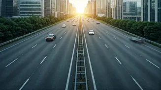
Become a Proactive Digital Citizen
These systems are only as good as the community that uses them. While benefiting from the information is great, contributing is what makes the system robust. If you are a passenger in a car or have pulled over safely, take a moment to report what you see. See a flooded underpass? Report it. A fallen tree blocking a lane? Report it. It's a small act that takes less than 30 seconds but has a massive positive impact. By confirming another user's report or adding your own, you are helping countless others make smarter, safer travel decisions. It’s a modern form of community service that strengthens the resilience of your entire city during a challenging season.