



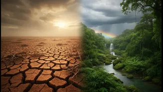



The Usual Suspect: El Niño’s Drying Effect
El Niño is a climate pattern characterized by the unusual warming of surface waters in the central and eastern Pacific Ocean. This massive shift of heat disrupts global atmospheric circulation. For India, this typically means a weaker Walker Circulation,
the east-west atmospheric cell over the tropics. This disruption often suppresses the moisture-laden winds that are the lifeblood of the southwest monsoon, leading to reduced rainfall across the subcontinent. Historically, a significant number of El Niño years have coincided with drought conditions in India, making it the primary factor to watch in seasonal forecasts. This link has made 'El Niño' a term of concern for farmers, economists, and policymakers alike, as a poor monsoon can strain water resources, impact crop yields, and fuel food inflation.
The Plot Twist: The Indian Ocean Dipole
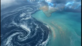
While El Niño is a powerful influence, it isn't the only player on the field. A crucial, and sometimes overriding, factor is the Indian Ocean Dipole (IOD), often called the Indian Ocean's own version of El Niño. The IOD is defined by the difference in sea surface temperatures between the western Indian Ocean (near the Arabian Sea) and the eastern Indian Ocean (near Indonesia). A 'positive' IOD phase occurs when the western part becomes warmer than the eastern part. This temperature difference pushes moisture-rich air towards the Indian subcontinent, effectively boosting monsoon activity. In years like 1997 and 2019, a strong positive IOD helped counteract the drying effects of an El Niño, leading to better-than-expected rainfall and showcasing its power to turn a potentially dire forecast around.
The Intraseasonal Wildcard: Madden-Julian Oscillation
Zooming in from seasonal patterns to weather on a weekly timescale, another phenomenon comes into play: the Madden-Julian Oscillation (MJO). The MJO is a massive, eastward-moving pulse of clouds, wind, and rain that circles the tropics every 30 to 60 days. Think of it as a traveling weather system that has an active phase and a suppressed phase. When the MJO's active, rainy phase is over the Indian Ocean, it can significantly enhance monsoon rainfall for a period of weeks, sometimes triggering the monsoon's onset or causing intense rain spells. Even in a broader El Niño-influenced season that might be generally dry, the timely arrival of an active MJO can deliver crucial bursts of heavy rain, breaking dry spells and adding another layer of unpredictability.
The New Reality: A Warming World
Underlying these natural cycles is the undeniable influence of global warming. Climate change is fundamentally altering the monsoon's behaviour. Scientists note that even when El Niño reduces the total number of rainy days, a warmer atmosphere and warmer oceans mean the air can hold more moisture. As a result, when it does rain, the rainfall is often more intense and occurs in short, extreme bursts. This creates a paradoxical situation where a season might be classified as having a rainfall deficit overall, yet still suffer from devastating floods and landslides due to the intensity of the downpours. This trend suggests we must prepare for both dry spells and intense deluges, sometimes within the same season.